Sunset Peak Trail
excerpted from our book
Salt Lake City's Incredible Hiking and Biking Trails
pages 118-121
|
Buy book directly from the author!
Salt Lake City's Incredible Hiking and Biking Trails
- has access info for 73 trailheads
- 73 colorful trail maps
- 325 full color photographs
- loads of hiking tips
|
regularly $19.95
now on sale for only
$9.95
click here
for book orders
|
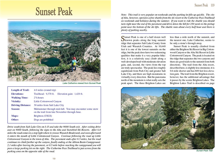
 Sunset Peak is one of a half dozen well known peaks along the long summit ridge that separates Salt Lake County from Utah and Wasatch
Counties. At 10,648 feet it is one of the lowest summits on the ridge, but the peak does have two redeeming qualities that make it a very popular hike: first,
it is a relatively easy climb along a well-developed trail with moderate elevation gain, and, second, the views from the top are truly spectacular. The peak
lies roughly equidistant from Park City and greater Salt Lake City, and there are high mountains in virtually every direction. But the panorama north of the
mountain is what really sets the Sunset Peak apart. The three Brighton Lakes are less than a mile north of the summit, and the nearest one, Lake Catherine, seems to
be only a stone’s through away.
Sunset Peak is one of a half dozen well known peaks along the long summit ridge that separates Salt Lake County from Utah and Wasatch
Counties. At 10,648 feet it is one of the lowest summits on the ridge, but the peak does have two redeeming qualities that make it a very popular hike: first,
it is a relatively easy climb along a well-developed trail with moderate elevation gain, and, second, the views from the top are truly spectacular. The peak
lies roughly equidistant from Park City and greater Salt Lake City, and there are high mountains in virtually every direction. But the panorama north of the
mountain is what really sets the Sunset Peak apart. The three Brighton Lakes are less than a mile north of the summit, and the nearest one, Lake Catherine, seems to
be only a stone’s through away.
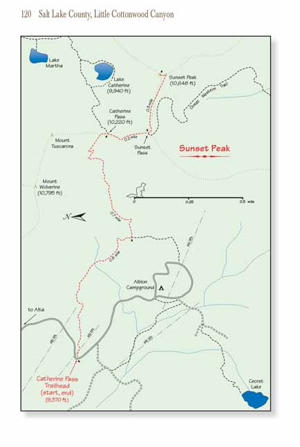
Sunset Peak is usually climbed from either the Brighton Ski Resort in Big Cottonwood Canyon or the Alta Ski Resort in Little Cottonwood Canyon. The peak is located
on the ridge that separates the two canyons and there are good trails to the summit from both directions. The trail from the Alta resort, described here, is
slightly less strenuous; it is 0.6 mile shorter and has 600 feet less elevation gain. The
Sunset Peak trail from the Brighton resort, however, has the additional advantage
that it passes by the scenic Brighton Lakes. The Brighton Lakes Trail is described on page 93; when you see how beautiful this area is you will probably want
to do them both!
The Sunset Peak trail leaves the Catherine Pass Trailhead in an easterly direction, climbing slowly up the rocky terrain between two of the Alta ski lifts. The elevation is
too high to support a dense forest, and although you will pass a few scattered groves of Engelmann spruce and subalpine fir there are few tall trees to block the
view. The land near the trailhead is part of an active ski resort and you may be put off by the presence of the service roads, but all of that will soon be left
behind. Most of the Sunset Peak trail is through a series of alpine meadows, and if you are doing this hike in late July or early August you will be treated to a stunning
variety of wildflowers.
After 0.8 mile the trail briefly passes through a section of privately owned land, and you will see another unmarked trail departing on the right that eventually
leads to a cabin. Bear left onto the main trail as it continues its gradual climb for the next 0.7 mile to the top of Catherine Pass. Catherine Pass is where
the Sunset Peak trail meets the Brighton Lakes Trail, and the junction is well marked by several signs. If you continue east you will be on the Brighton Lakes Trail. Lake
Catherine is 280 feet below the pass, and there is a marvelous view of the lake from the pass with Pioneer Peak rising behind it. Your goal, Sunset Peak, is
clearly visible 0.3 mile southeast of the pass.
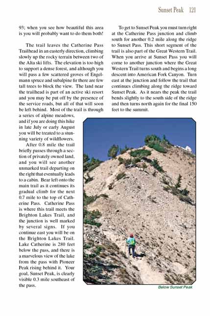
To get to Sunset Peak you must turn right at the Catherine Pass junction and climb south for another 0.2 mile along the ridge to Sunset Pass. This short segment
of the trail is also part of the Great Western Trail. When you arrive at Sunset Pass you will come to another junction where the Great Western Trail turns south
and begins a long descent into American Fork Canyon. Turn east at the junction and follow the trail that continues climbing along the ridge toward Sunset Peak.
As it nears the peak the trail bends slightly to the south side of the ridge and then turns north again for the final 150 feet to the summit.
Note to web developers: You may copy this material onto your site, but in return please include a link to my home page
www.utahtrails.com. Thank you, David Day (utahdavidday at gmail.com)
Click here to see more
trails near Salt Lake City
© Rincon Publishing Company, all rights reserved
|