Jordan River Parkway Trail
West Jordan to South Jordan
excerpted from our book
Salt Lake City's Incredible Hiking and Biking Trails
pages 151-155
|
Buy book directly from the author!
Salt Lake City's Incredible Hiking and Biking Trails
- has access info for 73 trailheads
- 73 colorful trail maps
- 325 full color photographs
- loads of hiking tips
|
regularly $19.95
now on sale for only
$9.95
click here
for book orders
|
 The further south one goes on the Jordan River Parkway
Trail the more bucolic the surrounding land becomes, and as you enter this
part of the trail it will soon become apparent that metropolitan Salt Lake City has been left far behind. You will pass a few small farms, golf courses
and residential areas, but a great deal of the land surrounding the river remains undeveloped. In fact, it was only a year before this book went to press
that a one-mile gap in the Jordan River Parkway Trail near the southern boundary of West Jordan was completed.
The further south one goes on the Jordan River Parkway
Trail the more bucolic the surrounding land becomes, and as you enter this
part of the trail it will soon become apparent that metropolitan Salt Lake City has been left far behind. You will pass a few small farms, golf courses
and residential areas, but a great deal of the land surrounding the river remains undeveloped. In fact, it was only a year before this book went to press
that a one-mile gap in the Jordan River Parkway Trail near the southern boundary of West Jordan was completed.
Probably the most interesting parts of this section of the
Jordan River Parkway Trail are at the beginning and at the end. As mentioned in the preceding chapter, Gardner
Village, at the beginning of the walk, was the site of a grist mill built in 1849 by the Gardner brothers. The mill attracted other commercial endeavors
and soon the area was transformed into South Jordan’s first industrial center. Unfortunately the grist mill is gone now, but the city has attempted to
preserve the historic site by restoring some of the antique cabins and houses and transforming them into boutiques and specialty retail shops.
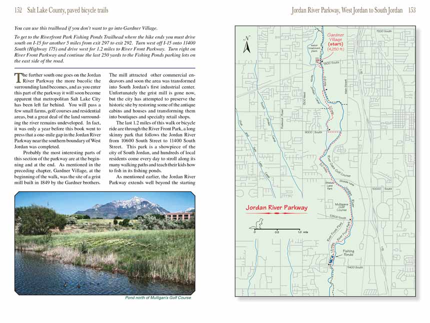
The last 1.2 miles of this walk or bicycle ride are through the River Front Park, a long skinny park that follows the Jordan River from 10600 South Street
to 11400 South Street. This park is a showpiece of the city of South Jordan, and hundreds of local residents come every day to stroll along its many walking
paths and teach their kids how to fish in its fishing ponds.
As mentioned earlier, the Jordan River Parkway
Trail extends well beyond the starting and ending points described here, so if you are interested in a longer bicycle
ride you can extend the distance in either direction. The trail north of Gardner Village is described in the preceding chapter, and the trail south of River
Front Park is described in the following chapter. The Jordan River Parkway
Trail can also be accessed from many intermediate points as well, so shorter walks and
rides are possible.
You will find a short connecter trail on the southeast corner of Gardner Village that goes under the railroad tracks
and joins the Jordan River Parkway Trail on the north side of 7800 South Street. From there the trail crosses under 7800 South and begins following the west side
of the river. After just 300 yards, however, the trail crosses to the east side of the river where you will come to a T-junction. A left turn will take you
to another trailhead and parking lot on the south side of 7800 South Street. This trailhead is a convenient starting point if you do not want to enter the
Gardner Village. Turn right at the T-junction to continue south.
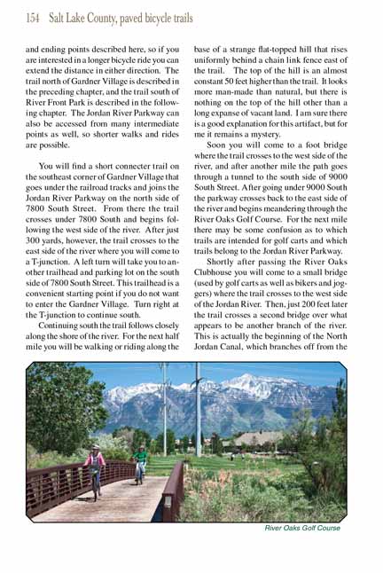
 Continuing south the Jordan River Parkway Trail follows closely along the shore of the river. For the next half mile you will be walking or riding along the base of a strange
flat-topped hill that rises uniformly behind a chain link fence east of the trail. The top of the hill is an almost constant 50 feet higher than the trail.
It looks more man-made than natural, but there is nothing on the top of the hill other than a long expanse of vacant land. I am sure there is a good
explanation for this artifact, but for me it remains a mystery.
Continuing south the Jordan River Parkway Trail follows closely along the shore of the river. For the next half mile you will be walking or riding along the base of a strange
flat-topped hill that rises uniformly behind a chain link fence east of the trail. The top of the hill is an almost constant 50 feet higher than the trail.
It looks more man-made than natural, but there is nothing on the top of the hill other than a long expanse of vacant land. I am sure there is a good
explanation for this artifact, but for me it remains a mystery.
Soon you will come to a foot bridge where the
Jordan River Parkway Trail crosses to the west side of the river, and after another mile the path goes through a tunnel to the south
side of 9000 South Street. After going under 9000 South the parkway crosses back to the east side of the river and begins meandering through the River Oaks
Golf Course. For the next mile there may be some confusion as to which trails are intended for golf carts and which trails belong to the Jordan River
Parkway Trail.
Shortly after passing the River Oaks Clubhouse you will come to a small bridge (used by golf carts as well as bikers and joggers) where the trail crosses
to the west side of the Jordan River. Then, just 200 feet later the trail crosses a second bridge over what appears to be another branch of the river.
This is actually the beginning of the North Jordan Canal, which branches off from the Jordan River 200 yards further upstream. Continuing southward along
the west side of the two waterways you will pass a small dam where water is diverted from the river into the canal. This point also marks the southern
boundary of West Jordan City, and 0.7 miles further the trail crosses under Shields Lane and emerges at South Jordan’s Shield’s Lane Park and Trailhead.
A mile later the Jordan River Parkway Trail passes yet another golf course, Mulligan’s Golf Course, before going under the bridge at 10600 South Street. (Golf courses seem to be
a popular feature of the Jordan River Parkway Trail.) On the south side of 10600 the trail passes a shopping center and office buildings before entering the long
expanse of River Front Park. This northeast corner of South Jordan was, in earlier years, an enormous wetland that extended for miles along the shores of
the Jordan River. Much of the land has now been developed, but significant portions still remain in a pristine state, particularly along the eastern side
of the river. The City of South Jordan is to be commended for its efforts to preserve this natural area.
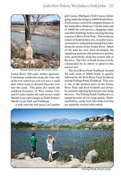
The East River Front Trailhead, located 0.6 mile south of 10600 South, is quickly followed by the West River Front Trailhead and the Fishing Ponds Trailhead.
This area is one of the prettiest parts of the Jordan River Parkway Trail, and local residents can always be seen here enjoying their leisure time along the river.
The Fishing Ponds Trailhead is so named because of two large ponds, Midas and Kidney, on the west side of the river that are regularly stocked with
catfish.
Note to web developers: You may copy this material onto your site, but in return please include a link to my home page
www.utahtrails.com. Thank you, David Day (utahdavidday
at gmail.com)
Click here to see more
trails near Salt Lake City
© Rincon Publishing Company, all rights reserved
|