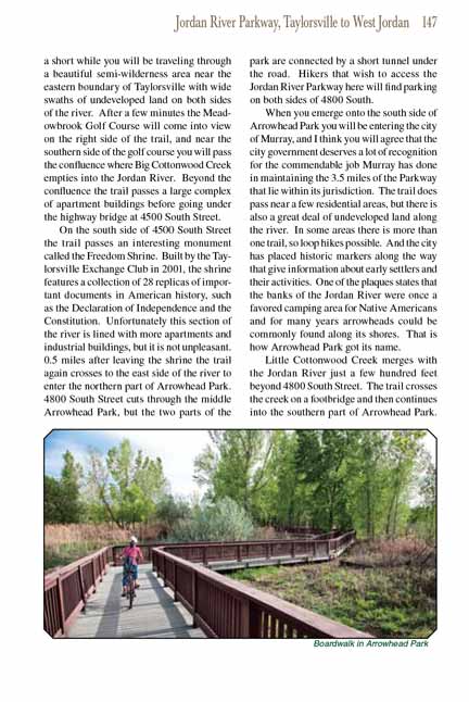
Jordan River Parkway Trail
Taylorsville to West Jordan
excerpted from our book
Salt Lake City's Incredible Hiking and Biking Trails
pages 144-150
|
Buy book directly from the author!
Salt Lake City's Incredible Hiking and Biking Trails
- has access info for 73 trailheads
- 73 colorful trail maps
- 325 full color photographs
- loads of hiking tips
|
regularly $19.95
now on sale for only
$9.95
click here
for book orders
|
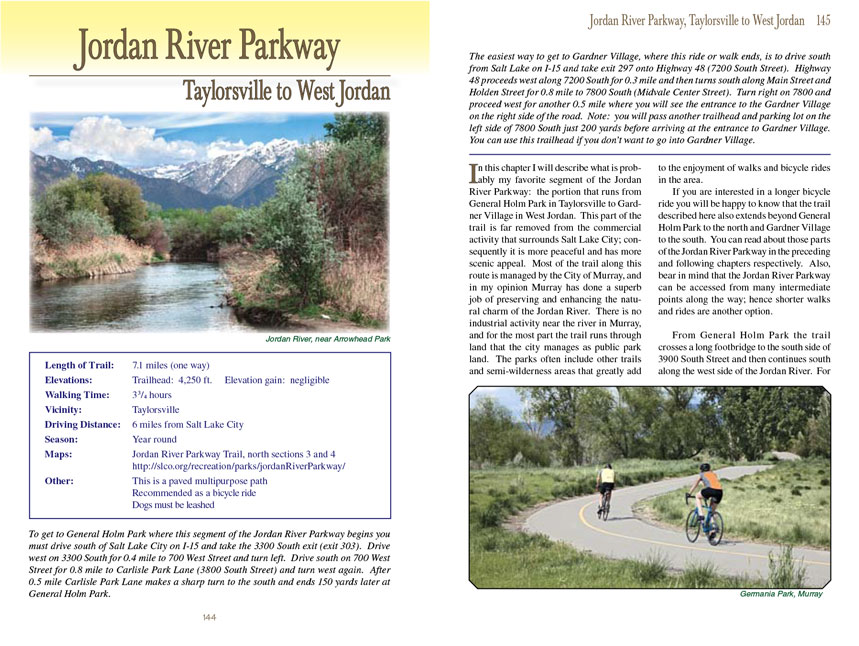
 In this chapter I will describe what is probably my favorite segment of the Jordan River Parkway: the portion that runs
from General Holm Park in Taylorsville to Gardner Village in West Jordan. This part of the trail is far removed from the commercial activity that
surrounds Salt Lake City; consequently it is more peaceful and has more scenic appeal. Most of the trail along this route is managed by the City
of Murray, and in my opinion Murray has done a superb job of preserving and enhancing the natural charm of the Jordan River. There is no industrial
activity near the river in Murray, and for the most part the Jordan River
Parkway trail runs through land that the city manages as public park land. The parks often
include other trails and semi-wilderness areas that greatly add to the enjoyment of walks and bicycle rides in the area.
In this chapter I will describe what is probably my favorite segment of the Jordan River Parkway: the portion that runs
from General Holm Park in Taylorsville to Gardner Village in West Jordan. This part of the trail is far removed from the commercial activity that
surrounds Salt Lake City; consequently it is more peaceful and has more scenic appeal. Most of the trail along this route is managed by the City
of Murray, and in my opinion Murray has done a superb job of preserving and enhancing the natural charm of the Jordan River. There is no industrial
activity near the river in Murray, and for the most part the Jordan River
Parkway trail runs through land that the city manages as public park land. The parks often
include other trails and semi-wilderness areas that greatly add to the enjoyment of walks and bicycle rides in the area.
If you are interested in a longer bicycle ride you will be happy to know that the trail described here also extends beyond General Holm Park to the north
and Gardner Village to the south. You can read about those parts of the Jordan River Parkway in the preceding and following chapters respectively.
Also, bear in mind that the Jordan River Parkway can be accessed from many intermediate points along the way; hence shorter walks and rides are another
option.
From General Holm Park the Jordan River
Parkway trail crosses a long footbridge to the south side of 3900 South Street and then continues south along the west side of the
Jordan River. For a short while you will be traveling through a beautiful semi-wilderness area near the eastern boundary of Taylorsville with wide
swaths of undeveloped land on both sides of the river. After a few minutes the Meadowbrook Golf Course will come into view on the right side of the
trail, and near the southern side of the golf course you will pass the confluence where Big Cottonwood Creek empties into the Jordan River. Beyond
the confluence the trail passes a large complex of apartment buildings before going under the highway bridge at 4500 South Street.
On the south side of 4500 South Street the
Jordan River Parkway trail passes an interesting monument called the Freedom Shrine. Built by the Taylorsville Exchange Club in
2001, the shrine features a collection of 28 replicas of important documents in American history, such as the Declaration of Independence and the
Constitution. Unfortunately this section of the river is lined with more apartments and industrial buildings, but it is not unpleasant. 0.5 miles
after leaving the shrine the trail again crosses to the east side of the river to enter the northern part of Arrowhead Park. 4800 South Street
cuts through the middle Arrowhead Park, but the two parts of the park are connected by a short tunnel under the road. Hikers that wish to access
the Jordan River Parkway here will find parking on both sides of 4800 South.
 When you emerge onto the south side of Arrowhead Park you will be entering the city of Murray, and I think you will
agree that the city government deserves a lot of recognition for the commendable job Murray has done in maintaining the 3.5 miles of the
Jordan River Parkway that
lie within its jurisdiction. The trail does pass near a few residential areas, but there is also a great deal of undeveloped land along the river.
In some areas there is more than one trail, so loop hikes possible. And the city has placed historic markers along the way that give information
about early settlers and their activities. One of the plaques states that the banks of the Jordan River were once a favored camping area for Native
Americans and for many years arrowheads could be commonly found along its shores. That is how Arrowhead Park got its name.
When you emerge onto the south side of Arrowhead Park you will be entering the city of Murray, and I think you will
agree that the city government deserves a lot of recognition for the commendable job Murray has done in maintaining the 3.5 miles of the
Jordan River Parkway that
lie within its jurisdiction. The trail does pass near a few residential areas, but there is also a great deal of undeveloped land along the river.
In some areas there is more than one trail, so loop hikes possible. And the city has placed historic markers along the way that give information
about early settlers and their activities. One of the plaques states that the banks of the Jordan River were once a favored camping area for Native
Americans and for many years arrowheads could be commonly found along its shores. That is how Arrowhead Park got its name.
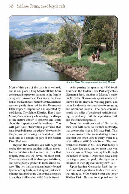
Little Cottonwood Creek merges with the Jordan River just a few hundred feet beyond 4800 South Street. The trail crosses the creek on a footbridge and
then continues into the southern part of Arrowhead Park. Most of this part of the park is a wetland, and in one place a long boardwalk has been
constructed to prevent damage to the fragile ecosystem. Arrowhead Park is also the location of the Kennecott Nature Center, a nature reserve partly
financed by the Kennecott Utah Copper Corporation and operated by the Murray City School District. Every year Murray’s elementary schools stage field
trips to the nature center to observe and learn about the importance of the wetlands. You will pass four observation platforms that have been built
near the edge of the water for the purpose of viewing the waterfowl. All said, this is a delightful part of the Jordan River Parkway.
Beyond the wetlands you will begin to notice the presence another trail, an unsurfaced equestrian trail nearer the river that roughly parallels the paved
multiuse trail. The equestrian trail is also open to hikers, and some people prefer its more rustic nature. The two trails are intermittently joined
by connecting trails, including one just a few minutes past the Nature Center that also goes to another trailhead on 4800 South Street.
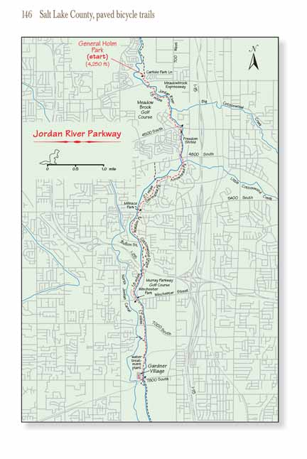
After passing the spur to the 4800 South Trailhead the Jordan River Parkway
trail enters Germania Park, another of Murray’s many public parks. Germania is a
particularly well known for its riverside walking paths, and many local residents come here for morning and afternoon strolls. The park contains nearly
two miles of developed paths, including the parkway trail, the equestrian trail, and the connecting trails.
Near the southern end of Germania Park you will come to another footbridge that crosses the river to Millrace Park. This park was named after a canal
along its west side that was once used to carry water to a grist mill near 4800 South Street. The most distinctive feature in Millrace Park today is
a 1.2-acre dog park, and on most days you can see dozens of dogs running free through the fenced-off area. (Dogs must have a dog park tag to enter
the park; the tags can be obtained at the City Hall in Taylorsville.)
 Upon leaving Germania Park the Jordan River
Parkway pedestrian and equestrian trails cross under the bridge at 5400 South Street and enter
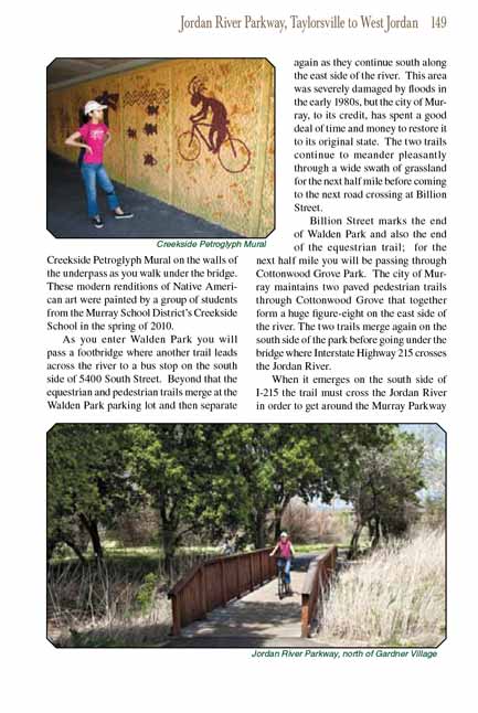
Walden Park. Be sure to stop and see the Creekside Petroglyph Mural on the walls of the underpass as you walk under the bridge. These modern renditions
of Native American art were painted by a group of students from the Murray School District’s Creekside School in the spring of 2010.
Upon leaving Germania Park the Jordan River
Parkway pedestrian and equestrian trails cross under the bridge at 5400 South Street and enter
Walden Park. Be sure to stop and see the Creekside Petroglyph Mural on the walls of the underpass as you walk under the bridge. These modern renditions
of Native American art were painted by a group of students from the Murray School District’s Creekside School in the spring of 2010.
As you enter Walden Park you will pass a footbridge where another trail leads across the river to a bus stop on the south side of 5400 South Street.
Beyond that the Jordan River Parkway equestrian and pedestrian trails merge at the Walden Park parking lot and then separate again as they continue south along the east
side of the river. This area was severely damaged by floods in the early 1980s, but the city of Murray, to its credit, has spent a good deal of time
and money to restore it to its original state. The two trails continue to meander pleasantly through a wide swath of grassland for the next half mile
before coming to the next road crossing at Billion Street.
Billion Street marks the end of Walden Park and also the end of the equestrian trail; for the next half mile you will be passing through Cottonwood Grove
Park. The city of Murray maintains two paved pedestrian trails through Cottonwood Grove that together form a huge figure-eight on the east side of the
river. The two Jordan River Parkway trails merge again on the south side of the park before going under the bridge where Interstate Highway 215 crosses the Jordan River.
When it emerges on the south side of I-215 the trail must cross the Jordan River in order to get around the Murray Parkway Golf Course. From there
the Jordan River Parkway trail
follows closely along the west side of the river for another 0.3 mile to Winchester Park. Winchester is a small but attractive park located in the
extreme southwest corner of Murray. The park is equipped with a boat launching ramp that can be used for launching canoes into the river, and it also
features a small duck pond. The trail passes under Winchester Street as it leaves the park, and 200 feet later it crosses the boundary between the
cities of Murray and West Jordan.
 After leaving Murray the Jordan River Parkway trail is rather uneventful. For the next half mile, between Winchester
Street and 7000 South, it follows closely along the west shore of the river as it winds through several residential areas. On the south side of 7000
South Street you will see another parking area with access to the trail. Then, 0.3 mile beyond 7000 South, you will pass an unsigned junction where
another spur trail departs on the right and climbs up to a residential area. This spur is of some interest because it crosses the North Jordan Canal,
which at this point is only 300 feet west of the Jordan River. This canal was built in the mid-1800s to carry irritation water from the Jordan River
to farmland in and around West Jordan, Taylorsville and beyond. Today, however, most of the canal’s water is used by the Kennecott Copper refining
facilities in Magna, Utah.
After leaving Murray the Jordan River Parkway trail is rather uneventful. For the next half mile, between Winchester
Street and 7000 South, it follows closely along the west shore of the river as it winds through several residential areas. On the south side of 7000
South Street you will see another parking area with access to the trail. Then, 0.3 mile beyond 7000 South, you will pass an unsigned junction where
another spur trail departs on the right and climbs up to a residential area. This spur is of some interest because it crosses the North Jordan Canal,
which at this point is only 300 feet west of the Jordan River. This canal was built in the mid-1800s to carry irritation water from the Jordan River
to farmland in and around West Jordan, Taylorsville and beyond. Today, however, most of the canal’s water is used by the Kennecott Copper refining
facilities in Magna, Utah.
Continuing south, the Jordan River Parkway Trail passes the east side of a large water treatment facility before crossing under the TRAX railroad tracks. It
then proceeds along a narrow strip of land between the tracks and the river for the next 0.4 mile before arriving at 7800 South Street. On the north
side of 7800 South you will find a small triangular-shaped picnic area, framed by the street, the river, and the railroad tracks. The historic Gardner
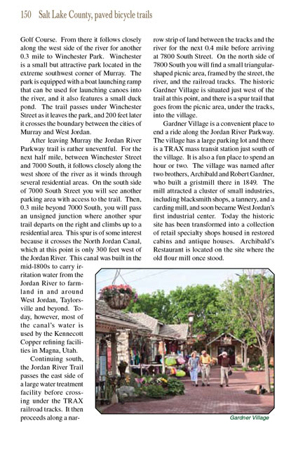
Village is situated just west of the Jordan River Parkway trail at this point, and there is a spur trail that goes from the picnic area, under the tracks, into the village.
Gardner Village is a convenient place to end a ride along the Jordan River Parkway. The village has a large parking lot and there is a TRAX mass transit
station just south of the village. It is also a fun place to spend an hour or two. The village was named after two brothers, Archibald and Robert
Gardner, who built a gristmill there in 1849. The mill attracted a cluster of small industries, including blacksmith shops, a tannery, and a carding
mill, and soon became West Jordan’s first industrial center. Today the historic site has been transformed into a collection of retail specialty shops
housed in restored cabins and antique houses. Archibald’s Restaurant is located on the site where the old flour mill once stood.
Note to web developers: You may copy this material onto your site, but in return please include a link to my home page
www.utahtrails.com. Thank you, David Day (utahdavidday
at gmail.com)
Click here to see more
trails near Salt Lake City
© Rincon Publishing Company, all rights reserved
|