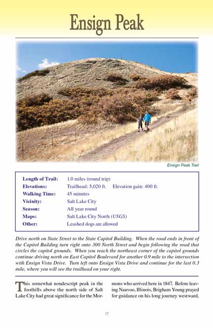
Ensign Peak Trail
excerpted from our book
Salt Lake City's Incredible Hiking and Biking Trails
pages 17-19
|
Buy book directly from the author!
Salt Lake City's Incredible Hiking and Biking Trails
- has access info for 73 trailheads
- 73 colorful trail maps
- 325 full color photographs
- loads of hiking tips
|
regularly $19.95
now on sale for only
$9.95
click here
for book orders
|
This somewhat nondescript peak in the foothills above the north side of Salt Lake City had great significance for the Mormons who
arrived here in 1847. Before leaving Nauvoo, Illinois, Brigham Young prayed for guidance on his long journey westward, and he later received a vision in which
Joseph Smith, the founder of their church, showed him a mountain peak overlooking a valley where his followers would build their new city. Upon his arrival
Young immediately recognized Ensign Peak as being the mountain he had seen in his vision. Two days later he and a small group of church leaders climbed
Ensign Peak, and looking down from the summit they began to formulate a plan for how the city would be laid out.
The Mormon pioneers regarded their movement to be the “latter-day gathering of Israel” prophesied in the bible, and in recognition of a passage in the Old
Testament, “And he shall set up an ensign for the nations, and shall assemble the outcasts of Israel... Lift ye up a banner upon the high mountain” (Isaiah
11:12; 13:2), they raised an American flag on the peak and named it Ensign Peak.
This special place lies directly north of both the Salt Lake Mormon Temple and the State Capital Building; consequently over the years it has been the site of
many subsequent flag raising ceremonies. In 1897 the city celebrated its fiftieth anniversary with a flag raising on Ensign Peak that included a 21-gun salute,
and a similar ceremony was held in 1947 to celebrate the city’s centennial. In 1996 the peak became the centerpiece of Salt Lake City’s new Ensign Peak Nature
Park, and now the trail is adorned with several brass plaques that describe the history and geology of the area. The Mormon Church also maintains an attractive
Ensign Peak Memorial Garden just below the official trailhead.
Upon leaving the elaborately landscaped trailhead you will initially be walking on a cement sidewalk. After just 250 feet the
Ensign Peak Trail splits, with the fork on the
left leading to an observation point called “Vista Mound”. Vista Mount offers a view of the city not unlike what you will see from the top of Ensign Peak,
although it is 350 feet lower than the summit.
Continuing upward on the Ensign Peak trail the cement sidewalk soon ends and is replaced by a heavily eroded dirt path. An attempt has been made to control the erosion
by building steps into the trail, but the attempt has been largely ineffective. An enormous number of people climb Ensign Peak every year, and there are trails
all over the mountain, including many shortcuts that bypass the steps. The Ensign Peak Foundation has also placed a series of poles and signs along the way in
an effort to keep all of the visitors on a single trail, but their efforts have been only partially successful.
0.2 mile from the trailhead you will pass another spur on the right that leads a short distance to the Ensign Peak Amphitheater, and from there it is another
0.2 mile to the crest of the summit ridge. When you reach the ridge the view on the north and west sides of the peak will suddenly open up before you. Directly
below the ridge are Salt Lake’s oil refineries, and three miles further west lie the runways of the Salt Lake City International Airport.
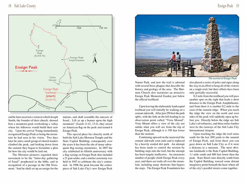
Upon reaching the ridge the Ensign Peak trail turns south for the last 200 yards to the summit of Ensign Peak, and from there you can gaze down on Salt Lake City as if it
were a diorama in a museum. The most obvious landmark is the State Capitol Building, 1.1 mile south and 880 feet lower than the peak. State Street runs directly
south from the Capitol Building, toward some distant imaginary point beneath the haze where all of the city’s parallel streets come together.
Note to web developers: You may copy this material onto your site, but in return please include a link to my home page
www.utahtrails.com. Thank you, David Day (utahdavidday
at gmail).com
Click here to see more
trails near Salt Lake City
© Rincon Publishing Company, all rights reserved
|