Bells Canyon Trail
excerpted from our book
Salt Lake City's Incredible Hiking and Biking Trails
pages 102-106
|
Buy book directly from the author!
Salt Lake City's Incredible Hiking and Biking Trails
- has access info for 73 trailheads
- 73 colorful trail maps
- 325 full color photographs
- loads of hiking tips
|
regularly $19.95
now on sale for only
$9.95
click here
for book orders
|
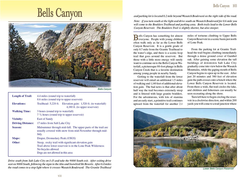
 Bells Canyon has something for almost everyone. People with young children often walk only as far as the Lower Bells Canyon
Reservoir. It is a gentle grade of only 0.7 mile from the Granite Trailhead to the water’s edge, and there is a scenic loop trail that goes around the reservoir.
But those with a little more energy will surely want to continue on to the Bells Canyon Waterfall, a picturesque 80-foot plunge in Bells Canyon Creek that is a
favorite destination among young people in nearby Sandy.
Bells Canyon has something for almost everyone. People with young children often walk only as far as the Lower Bells Canyon
Reservoir. It is a gentle grade of only 0.7 mile from the Granite Trailhead to the water’s edge, and there is a scenic loop trail that goes around the reservoir.
But those with a little more energy will surely want to continue on to the Bells Canyon Waterfall, a picturesque 80-foot plunge in Bells Canyon Creek that is a
favorite destination among young people in nearby Sandy.
Getting to the waterfall from the lower reservoir will entail an additional 1.5 miles of walking and 1,140 feet of additional elevation gain. The bad news is
that after about half way the Bells Canyon trail becomes extremely steep and is littered with large granite boulders. For the adventurous, with lots of stamina and an early
start, a primitive trail continues upward from the waterfall for another 2.1 miles of tortuous climbing to Upper Bells Canyon Reservoir in a scenic basin just
north of Lone Peak.
From the parking lot at Granite Trailhead the
Bells Canyon trail begins climbing immediately through a dense ground cover of Gambel oak. After gaining some elevation the tall
buildings of downtown Salt Lake City gradually come into view below the Wasatch Mountains, while the gaping mouth of Bells Canyon begins to open up in the east.
After just 20 minutes and 380 feet of elevation gain the path crosses onto a bench where the Lower Bells Canyon Reservoir is located. From there a wide, flat
trail circles the lake, and children and fishermen can usually be seen recreating along the shore.
Turn left here to begin circling the reservoir in a clockwise direction, and within 200 yards you will come to a trail junction where the Forest Service trail
into Bells Canyon begins. Pause to look into the rugged canyon ahead; the white granite cliffs on the north side of the canyon are the Bell Towers, after which
the canyon was named. The Bells Canyon Waterfall is located near the base of the Bell Towers, but if the upper reservoir is your destination you will be climbing
higher into the canyon above the granite cliffs.
 As you begin your trek into the canyon the trail is initially quite pleasant and well shaded by maple trees that slowly replace
the Gambel oak. After 0.7 mile, shortly after crossing a small footbridge to the south side of the creek, you will enter the Lone Peak Wilderness Area, and
from that point the Bells Canyon trail becomes noticeably steeper and less well maintained. There are very few switchbacks on this trail. Basically you will be walking
straight up the boulder-strewn slopes in the back of the canyon.
As you begin your trek into the canyon the trail is initially quite pleasant and well shaded by maple trees that slowly replace
the Gambel oak. After 0.7 mile, shortly after crossing a small footbridge to the south side of the creek, you will enter the Lone Peak Wilderness Area, and
from that point the Bells Canyon trail becomes noticeably steeper and less well maintained. There are very few switchbacks on this trail. Basically you will be walking
straight up the boulder-strewn slopes in the back of the canyon.
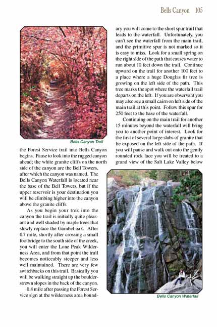
0.8 mile after passing the Forest Service sign at the wilderness area boundary you will come to the short spur trail that leads to the waterfall. Unfortunately,
you can’t see the waterfall from the main trail, and the primitive spur is not marked so it is easy to miss. Look for a small spring on the right side of the
path that causes water to run about 10 feet down the trail. Continue upward on the trail for another 100 feet to a place where a huge Douglas fir tree is
growing on the left side of the path. This tree marks the spot where the waterfall trail departs on the left. If you are observant you may also see a small
cairn on left side of the main trail at this point. Follow this spur for 250 feet to the base of the waterfall.
Continuing on the Bells Canyon trail for another 15 minutes beyond the waterfall will bring you to another point of interest. Look for the first of several large slabs
of granite that lie exposed on the left side of the path. If you will pause and walk out onto the gently rounded rock face you will be treated to a grand view
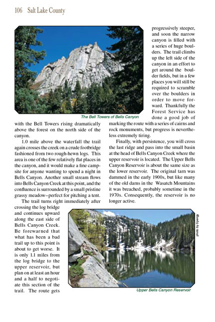
of the Salt Lake Valley below with the Bell Towers rising dramatically above the forest on the north side of the canyon.
1.0 mile above the waterfall the Bells Canyon trail again crosses the creek on a crude footbridge fashioned from two rough-hewn logs. This area is one of the few relatively
flat places in the canyon, and it would make a fine campsite for anyone wanting to spend a night in Bells Canyon. Another small stream flows into Bells Canyon
Creek at this point, and the confluence is surrounded by a small pristine grassy meadow-perfect for pitching a tent.
The Bells Canyon trail turns right immediately after crossing the log bridge and continues upward along the east side of Bells Canyon Creek. Be forewarned that what has been
a bad trail up to this point is about to get worse. It is only 1.1 miles from the log bridge to the upper reservoir, but plan on at least an hour and a half to
negotiate this section of the trail. The route gets progressively steeper, and soon the narrow canyon is filled with a series of huge boulders. The trail
climbs up the left side of the canyon in an effort to get around the boulder fields, but in a few places you will still be required to scramble over the
boulders in order to move forward. Thankfully the Forest Service has done a good job of marking the route with a series of cairns and rock monuments, but
progress is nevertheless extremely tiring.
Finally, with persistence, you will cross the last ridge and pass into the small basin at the head of Bells Canyon Creek where the upper reservoir is located.
The Upper Bells Canyon Reservoir is about the same size as the lower reservoir. The original tarn was dammed in the early 1900s, but like many of the old dams
in the Wasatch Mountains it was breached, probably sometime in the 1970s. Consequently, the reservoir is no longer active.
Note to web developers: You may copy this material onto your site, but in return please include a link to my home page
www.utahtrails.com. Thank you, David Day (utahdavidday
at gmail.com)
Click here to see more
trails near Salt Lake City
© Rincon Publishing Company, all rights reserved
|