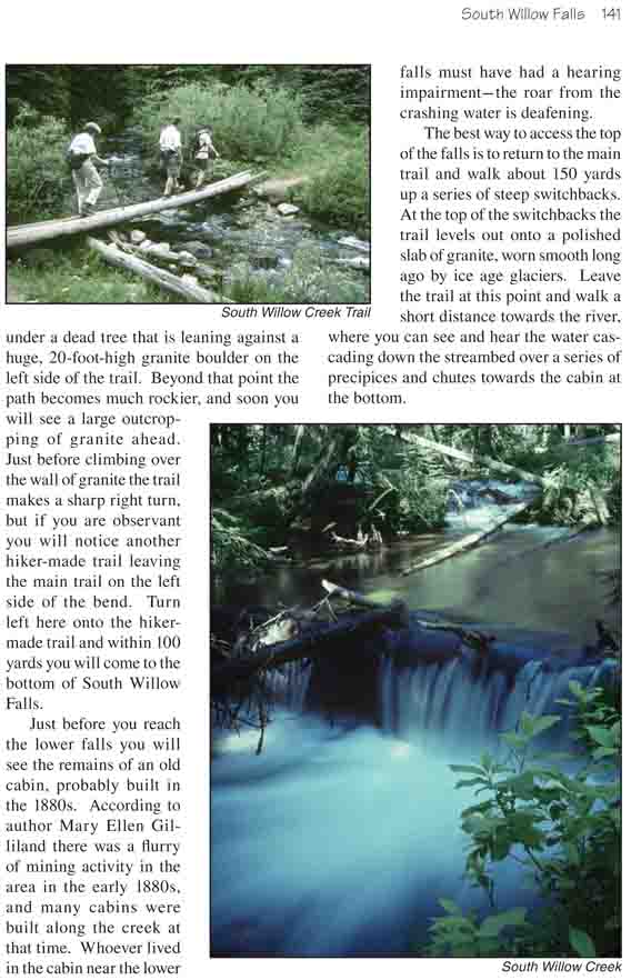
This easy hike follows the Mesa Cortina Trail from the
outskirts of Silverthorne into the Eagles Nest Wilderness Area where it
meets South Willow Creek and the Gore Range Trail. It then follows the Gore
Range Trail up the north side of the fast-flowing stream, finally to arrive
at South Willow Falls. Those wanting a longer hike can continue from the
falls to Red Buffalo Pass, Gore Lake and beyond. But the walk as far as
South Willow Falls makes a nice day hike, and that is what I will describe
here.
The trail is flat or even slightly downhill for the first
15 minutes, as it winds through several small meadows. The grassy,
flower-filled parks, bordered by quaking aspen, make for a very pleasant
beginning to the hike. The only distraction is the noise from traffic on
nearby I-70. It will be nearly an hour before the highway noise completely
disappears.
After about 20 minutes the trail crosses into the Eagles
Nest Wilderness Area, and at about this point it shifts into a long, gentle
uphill climb. Soon you will enter an area littered with fallen trees,
probably felled by a windstorm many years ago. Most of the new trees in this
area are lodgepole pine, but none of them appear to be more than about 50
years old. Fortunately the windfall area does not last long, and soon you
are back in a shady forest of standing timber.
2.7 miles from the trailhead the trail crosses South
Willow Creek and soon afterward arrives at sign marking the Gore Range
Trail. This is a lovely area with several good campsites near the delightful
fast-flowing stream. To reach the South Willow Falls you must turn left at
the trail junction and follow the Gore Range Trail along the north side of
the creek for another 1.7 miles. Notice the presence of many more Engelmann
spruce and subalpine fir as you climb out of the montane forest into a
subalpine life zone.
Not far from the trail junction the path passes several
ponds where a colony of beaver have dammed the creek. Notice the dead trees
that line the ponds-killed by the rising water level of the beaver ponds.
Then, just over a mile from the Mesa Cortina Trail, you will come to another
signed trail junction where the Buffalo Mountain Trail departs on the left.
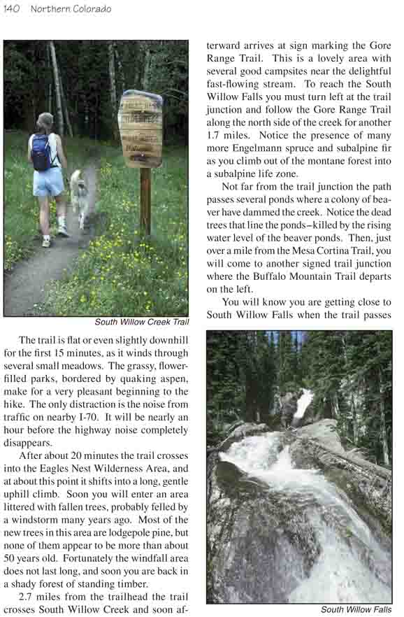
You will know you are getting close to South Willow Falls
when the trail passes under a dead tree that is leaning against a huge,
20-foot-high granite boulder on the left side of the trail. Beyond that
point the path becomes much rockier, and soon you will see a large
outcropping of granite ahead. Just before climbing over the wall of granite
the trail makes a sharp right turn, but if you are observant you will notice
another hiker-made trail leaving the main trail on the left side of the
bend. Turn left here onto the hiker-made trail and within 100 yards you will
come to the bottom of South Willow Falls.
Just before you reach the lower falls you will see the
remains of an old cabin, probably built in the 1880s. According to author
Mary Ellen Gilliland there was a flurry of mining activity in the area in
the early 1880s, and many cabins were built along the creek at that time.
Whoever lived in the cabin near the lower falls must have had a hearing
impairment-the roar from the crashing water is deafening.
The best way to access the top of the falls is to return
to the main trail and walk about 150 yards up a series of steep switchbacks.
At the top of the switchbacks the trail levels out onto a polished slab of
granite, worn smooth long ago by ice age glaciers. Leave the trail at this
point and walk a short distance towards the river, where you can see and
hear the water cascading down the streambed over a series of precipices and
chutes towards the cabin at the bottom.