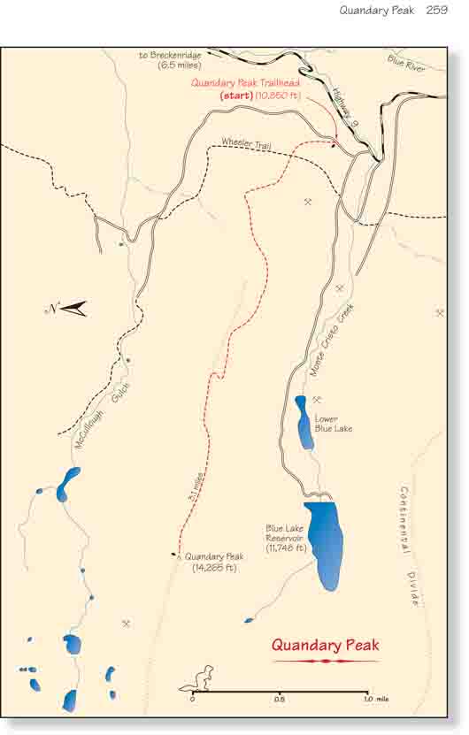
As Colorado’s fourteeners go, Quandary Peak is a
relatively easy hike. Like all fourteeners, getting to the top requires a
significant expenditure of energy, but the climb is only 3.1 miles long and
there is now an excellent trail most of the way. Before 2001 the trail was
much more primitive, but it has since been significantly improved by an
organization called the Colorado Fourteeners Initiative. The trail has been
rerouted up the south side of the mountain’s east ridge, and long sections
of stone stair steps have been constructed in several areas to facilitate
the assent. Its easy access has made Quandary Peak one of the state’s most
popular 14,000-foot climbs. Even in winter a surprising number of people
carry skis and snowboards to the to summit for the descent down the
mountain’s gentle eastern slopes.
The trail begins by angling up from the road into an
open forest of Engelmann spruce and subalpine fir. Soon the path begins
to turn from north to west, crossing over two or three faint jeep roads
as it continues its moderate climb. After about 30 minutes you will see
a section of the old Quandary Peak trail departing on the right, and
soon afterward, at an elevation of about 11,700 feet, the route crosses
timberline.
With the trees gone it is easier to see what lies
ahead. The path can be seen climbing up the south side of the ridge and
apparently ending at a false summit a mile ahead. At first the false
summit blocks the real summit from view, but as you climb higher you
will soon be able to see the top of Quandary Peak rising above the left
side of the ridge.
The trail finally reaches the crest of the ridge at an
elevation of 12,900 feet, and from that point you can begin to appreciate
the great views across McCullough Gulch to the north and Monte Cristo Creek
to the south. The Continental Divide runs in an east-west direction 1.2
miles south of Quandary, and in between lie the Blue Lakes of Monte Cristo
Creek.
After crossing the false summit at an elevation of 13,146
feet the trail continues almost due west along the crest of the ridge for
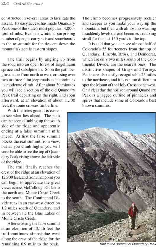
the remaining 0.9 mile to the peak. The climb becomes progressively rockier
and steeper as you make your way up the mountain, but then with almost no
warning it suddenly levels out and becomes a relaxing stroll for the last
150 yards to the top.
It is said that you can see almost half of Colorado’s 55
fourteeners from the top of Quandary. Lincoln, Bross, and Democrat, which
are only two miles south of the Continental Divide, are the nearest ones.
The distinctive shapes of Grays and Torreys Peaks are also easily
recognizable 25 miles to the northeast, and it is not too difficult to spot
the Mount of the Holy Cross to the west. On a clear day the horizon around
Quandary Peak is a jagged outline of pinnacles and spires that include some
of Colorado’s best known summits.