By Colorado standards Mount McConnel is scarcely a
mountain at all but rather an 8,000-foot hill of the northeast side of the
Front Range. Nevertheless its location, just west of Fort Collins and high
above the beautiful Poudre River Valley, has made it a popular hike. Like
many of the trails in Colorado, the trail to the top of Mount McConnel was
built in the mid-1930s by the Civilian Conservation Corps. More recently the
lower part of the trail has been made into a nature walk with interpretive
plaques at key points along the way that provide information about the
history and ecology of the area.
The nature walk portion of the Mount McConnel Trail is
called the Kreutzer Trail in recognition of William R. Kreutzer, a Colorado
resident who in 1898 became the first official forest ranger in the United
States. Kreutzer worked for the Forest Service for 41 years, finally serving
as the Supervisor of Roosevelt National Forest before his retirement in
1939. Mount McConnel itself was named after another early forest ranger, R.
C. McConnel, who served in the Poudre District of Roosevelt National Forest
in the early 1900s. The mountain became part of the Cache La Poudre
Wilderness Area in 1980.
From the lower parking area the trail first climbs a
short distance to cross the upper Mountain Park Road, and then continues
a long gradual assent through an open forest of ponderosa pine and
Douglas fir. One thing you may notice is that there are no very old
trees. The reason is that from 1868 until the turn of the century the
hills in this area were essentially stripped of all their timber. The
trees were initially cut to provide ties for the Union Pacific and
Denver Pacific Railroads, and later to satisfy the demand for lumber in
Fort Collins and other nearby settlements. The Logging activities were
completely unregulated until 1905, when President Roosevelt placed the
area under the jurisdiction of what is today the National Forest
Service. Today great progress has been made in the reforestation of the
area, especially on the north-facing slopes of the mountains. But none
of the trees you will see are over 100 years old.
After 0.7 miles you will come to a junction where the
Kreutzer Trail departs to begin a relatively flat traverse across the
northern flank of the mountain. The Kreutzer Trail again intersects the
Mount McConnel summit trail after 0.8 miles, so if you are interested in a
shorter hike you can turn left here and continue along the nature trail. The
total length of Kreutzer loop is 2.2 miles. To continue the assent of Mount
McConnel you must bear right at the junction, but whatever you decide this
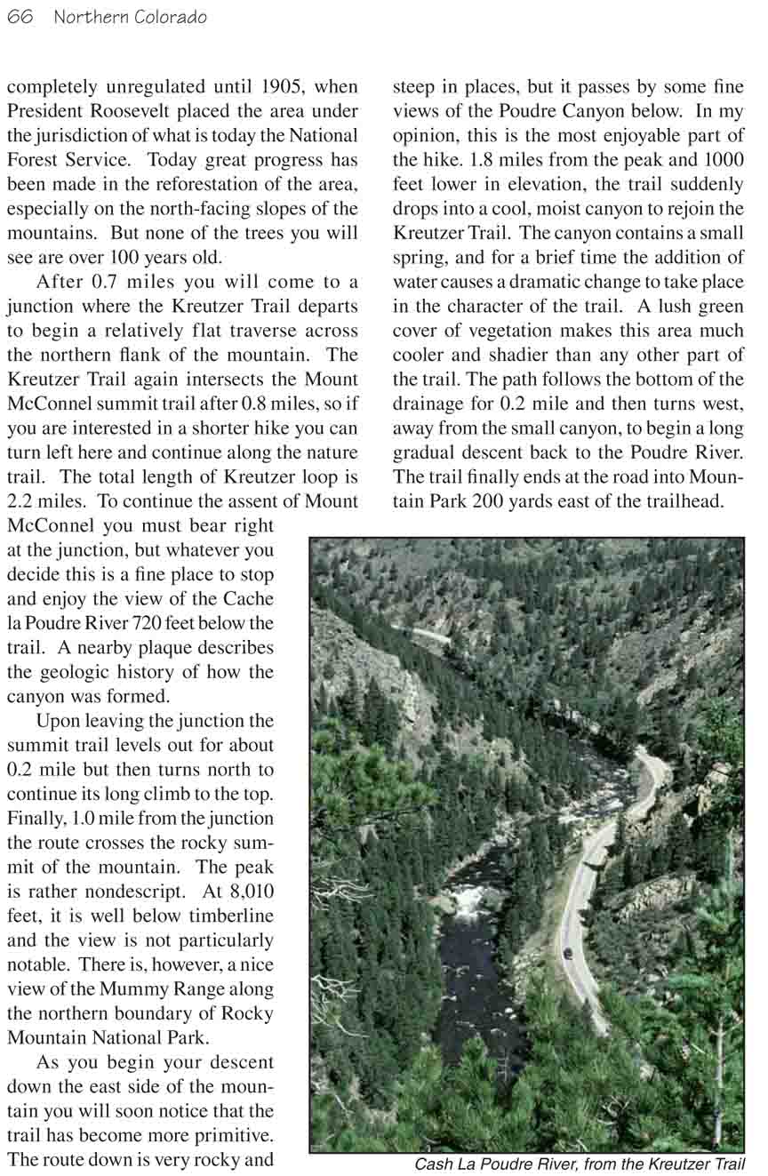
is a fine place to stop and enjoy the view of the Cache la Poudre River 720
feet below the trail. A nearby plaque describes the geologic history of how
the canyon was formed.
Upon leaving the junction the summit trail levels out for
about 0.2 mile but then turns north to continue its long climb to the top.
Finally, 1.0 mile from the junction the route crosses the rocky summit of
the mountain. The peak is rather nondescript. At 8,010 feet, it is well
below timberline and the view is not particularly notable. There is,
however, a nice view of the Mummy Range along the northern boundary of Rocky
Mountain National Park.
As you begin your descent down the east side of the mountain you will
soon notice that the trail has become more primitive. The route down is very
rocky and steep in places, but it passes by some fine views of the Poudre
Canyon below. In my opinion, this is the most enjoyable part of the hike.
1.8 miles from the peak and 1000 feet lower in elevation, the trail suddenly
drops into a cool, moist canyon to rejoin the Kreutzer Trail. The canyon
contains a small spring, and for a brief time the addition of water causes a
dramatic change to take place in the character of the trail. A lush green
cover of vegetation makes this area much cooler and shadier than any other
part of the trail. The path follows the bottom of the drainage for 0.2 mile
and then turns west, away from the small canyon, to begin a long gradual
descent back to the Poudre River. The trail finally ends at the road into
Mountain Park 200 yards east of the trailhead.