As you may already know, Mount Massive is the second
highest peak in the Colorado Rockies. At one time it was thought to be the
highest peak, but a later survey determined that the nearby Mount Elbert was
slightly higher. Mount Massive, however, will always reign supreme in one
respect. As its name suggests, the sheer volume of the mountain is far
larger than any other fourteener in Colorado. The huge massif contains some
300 acres of land above the 14,000-foot level, including two other nearby
peaks, South Massive and North Massive that rise to 14,132 feet and 14,340
feet respectively. The other two peaks are not officially classified as
stand-alone fourteeners, however, because the connecting saddles between
them and the main summit are not quite 300 feet lower in elevation, as
tradition demands.
From the parking area the trail enters an open forest
of lodgepole pine and immediately starts climbing through the trees
along a fairly moderate grade. Within 200 feet you will cross the
boundary of the Mount Massive Wilderness Area, and soon all of the
sounds of civilization will be behind you. You may notice that all the
trees seem to be about the same size along certain segments of the
trail. In the late 1800s and early 1900s this area was heavily logged by
both lumberjacks and miners looking for fuel for their steam boilers. A
hundred years later the forest seems to be recovering nicely, but it is
still rare to see a tree more than a foot in diameter. 1.8 miles from
the trailhead the trail passes by one of the old mining claims. Watch
for the old prospector’s broken-down cabin just below the right side of
the path. The roof has caved in now and the dwelling has been reduced to
not much more than a disorganized pile of logs,
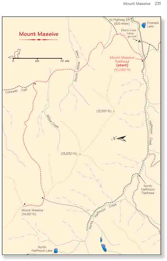
After 3.4 miles the trail comes to a fork where the
Colorado Trail continues straight ahead and the Mount Massive Trail
turns off to the left. The first half of the trail climbs only
gradually, gaining just 1,200 feet over the 3.4 miles to the trail
junction, but beyond the junction it starts climbing at a faster rate.
Also you will notice that by the time you reach the junction the trees
are somewhat smaller and the species have changed from lodgepole pine to Engelmann spruce and subalpine
fir.
0.7 miles from the junction, at an elevation of about
11,800 feet, the trail crosses timberline and continues climbing upward at a
steady rate of about 1,200 feet/mile. Soon you will see the south summit of
Massive directly in front of you and the main summit on the far right. For
the next 2.0 miles the trail climbs relentlessly westward until it finally
reaches the saddle between the two peaks.
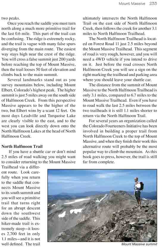
Once you reach the saddle you must turn north along a
much more primitive trail for the last 0.6 mile. This part of the trail can
be confusing. The ridge is extremely rocky, and the trail is vague with many
false spurs diverging from the main route. The easiest way stays high near
the crest of the ridge. You will cross a false summit just 200 yards before
reaching the top of Mount Massive, then the trail looses 50 feet of
elevation and climbs back to the main summit.
Several landmarks stand out as you survey mountains
below, including Mount Elbert, Colorado’s highest peak. The higher summit is
just 5 miles away on the south side of Halfmoon Creek. From this perspective
Massive appears to be the higher of the two, but Elbert wins by a scant 12
feet. On most days Leadville and Turquoise Lake are clearly visible to the
east, and to the west you can look directly down onto the North Halfmoon
Lakes at the head of North Halfmoon Creek.
North Halfmoon Trail
If you have a shuttle car or don’t mind 2.5 miles of road
walking you might want to consider returning to the Mount Massive Trailhead
via a different route. Look carefully when you return to the saddle that
connects Mount Massive to its south summit and you will see a primitive
trail that turns right for an abrupt descent down the southwest side of the
saddle. This hiker-made trail is extremely steep-it looses 2,700 feet in
only 1.1 miles-and it is not well defined. The trail ultimately intersects
the North Halfmoon Trail on the east side of North Halfmoon Creek, then
follows the creek for another 3.1 miles to North Halfmoon Trailhead.
The North Halfmoon Trailhead is located on Forest Road 11
just 2.5 miles beyond the Mount Massive Trailhead. This segment of road is
very rough, however, and you will need a 4WD vehicle if you intend to drive
on it. Just before the road crosses North Halfmoon Creek you will see a sign
on the right marking the trailhead and parking area where you should leave
your shuttle car.
The distance from the summit of Mount Massive to the
North Halfmoon Trailhead is only 3.1 miles, compared to 6.7 miles to the
Mount Massive Trailhead. Even if you have to road walk the last 2.5 miles
between the two trailheads it is still 1.1 miles shorter to return via the
North Halfmoon Trail.
For several years an organization called the Colorado
Fourteeners Initiative has been involved in building a proper trail from
North Halfmoon Creek to the top of Mount Massive, and when they finish their
work this alternative route will probably be the most popular way to climb
the mountain. As this book goes to press, however, the trail is still far
from complete.