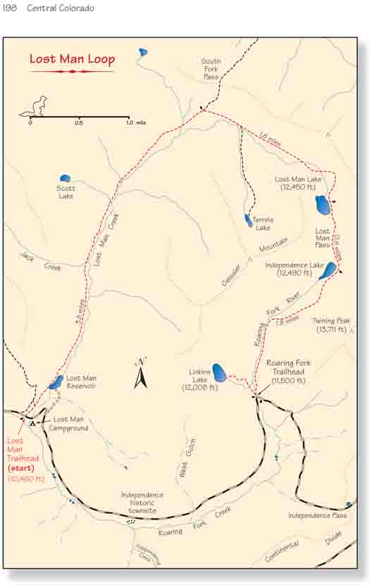
Despite its close proximity to the resort town of Aspen,
the Hunter-Fryingpan Wilderness Area is often overlooked as a prime hiking
area. Its larger neighbors, Maroon Bells-Snowmass Wilderness and Collegiate
Peaks Wilderness, with their many famous fourteen-thousand-foot peaks get
all the attention. Hunter-Fryingpan has no summits that can compete with the
Maroon Bells or Snowmass Mountain, but rather its special attraction is the
high glacial river valleys on the western slopes of the Continental Divide.
Roaring Fork River, Fryingpan River, and Hunter Creek all originate within
the boundaries of Hunter-Fryingpan, and the high open valleys at their
headwaters are exceedingly scenic.
Most of the trails in the Hunter-Fryingpan Wilderness
Area follow the glacier-carved valleys, typically climbing to the top of one
valley, crossing over a pass, and then descending into another valley. The
hike described here follows Lost Man Creek for 5.5 miles to its source at
Lost Man Lake, then climbs over Lost Man Pass and descends along the Roaring
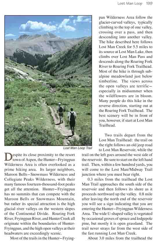
Fork River to Roaring Fork Trailhead. Most of the hike is through subalpine
meadowland just below timberline. The views across the open valleys are
terrific-especially in midsummer when the wildflowers are in bloom. Many
people do this hike in the reverse direction, starting out at the Roaring
Fork Trailhead. The best scenery will be in front of you, however, if start
at Lost Man Trailhead.
Two trails depart from the Lost Man Trailhead: the trail
on the right follows an old jeep road to Lost Man Reservoir, while the trail
on the left goes around the west side of the reservoir. Be sure to start on
the left hand trail. Then, within a few hundred yards, you will come to the
Lost Man/Midway Trail junction where you must bear right.
0.3 miles from the trailhead the Lost Man Trail
approaches the south side of the reservoir and then follows its shore as it
proceeds northward up the valley. 0.8 mile after leaving the north end of
the reservoir you will see a sign indicating that you are entering the
Hunter-Fryingpan Wilderness Area. The wide U-shaped valley is vegetated by
occasional groves of spruce and lodgepole pine, but mostly it is open
grassland. The trail never strays far from the west side of the fast running
Lost Man Creek.
About 3.0 miles from the trailhead the trail begins
making a long sweeping turn to the east as it follows the creek bed. Then,
at mile 3.8 it meets the junction with South Fork Pass Trail. This trail
makes an interesting side trip for people wishing to make this a two-day
hike. Deadman Lake is only two miles from the junction along South Fork Pass
Trail, and their are plenty of fine campsites nearby. Unfortunately, there
are no fish in Deadman Lake-probably because the winters are occasionally
severe enough to kill all of the fish.
Unless you are making a side trip to Deadman Lake, bear
right at the South Fork Pass junction and continue climbing eastward along
the north shore of Lost Man Creek. The scenery in the upper reaches of the
Lost Man Creek Valley is especially dramatic. The valley climbs eastward for
1.6 miles to a point just below the ridge of the Continental Divide then
turns abruptly south into a small bowl wherein lies Lost Man Lake. By the
time you reach the lake you will be well above timberline, and the rocky
shore that surrounds the small lake is typical alpine tundra. Beyond the
lake the trail climbs steeply to the ridge south of the lake, gaining 400
feet in 0.3 mile. When you reach the top of the ridge you will be in Lost
Man Pass (12,820 ft.), the highest point on the hike.
The last 2.3 miles of trail are all downhill. From the
top of Lost Man Pass the route winds down to the west side of Independence
Lake, then continues on down the Roaring Fork drainage to the trailhead.
Like Lost Man Lake, Independence Lake is located in a small bowl west of the
Continental Divide. It is also about the same size and elevation and deep
enough that it does not freeze solid in the winter. The fishing is fair to
good in both lakes. Independence Lake is an easy 2.0 mile walk from the
Roaring Fork Trailhead; consequently you are likely to see many more hikers
on this last section of the trail. But most of these hikers will miss the
best part of the loop. Although the scenery along Roaring Fork is nice, it
can’t really compare to the grandeur of the upper Lost Man Creek Drainage.
Finally, 0.2 mile before you reach the highway, you will see another
short spur trail departing on the right for Linkins Lake. If you still have
energy left you might want to make the 0.8 mile round-trip side trip to
Linkins, but be advised that the trail involves another steep and tiring
climb. You must gain another 400 feet of elevation in 0.4 mile. Linkins Lake
is situated right on the edge of timberline at an elevation of 12,008 feet.
It lies on a small bench at the base of a north-south ridge called Greissler
Mountain. From the Linkins Lake trail junction it is a five-minute downhill
walk to the point where Roaring Fork crosses the highway at the trailhead.