The Buffalo Meadows Loop is a somewhat long but very
pleasant day hike that will take you through an interesting variety of
mountain ecosystems. The route starts at the South Fork of the South Platte
River and follows Rich Creek, a smaller tributary, to its headwaters. It
then crosses a gentle alpine pass and drops down into the wide grassy valley
known as Buffalo Meadows. From there the trail follows the Rough and
Tumbling Creek down into a gorgeous riparian area that includes numerous
beaver dams and lodges. Finally, the trail climbs up over the ridge that
separates Rough and Tumbling Creek from the South Fork South Platte and
returns to the trailhead.
Immediately after leaving the parking area the trail
crosses a well-constructed bridge that spans the South Fork of the South
Platte River. Once on the south side of the river the trail turns right, and
within 200 feet you will see a sign marking the beginning of the Buffalo
Meadows loop. This loop can be walked in either direction, but the hike I
describe below assumes you will bear right at the sign and begin by
following Rich Creek.
Over the next 30 minutes the trail crosses Rich Creek
three times, finally coming to a junction above the north side of the creek
where a spur trail branches off toward the Weston Pass Campground. Continue
straight ahead at this junction, following the north side of Rich Creek in a
westerly direction. The trail stays on the right side of the creek for the
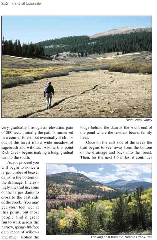
next 2.1 miles, climbing very gradually through an elevation gain of 800
feet. Initially the path is immersed in a conifer forest, but eventually it
climbs out of the forest into a wide meadow of sagebrush and willows. Also
at this point Rich Creek begins making a long, gradual turn to the south.
As you proceed you will begin to notice a large number of
beaver dams in the bottom of the drainage. Interestingly, the trail uses one
of the larger dams to cross to the east side of the creek. You may get your
feet wet at this point, but most people find it great fun to walk across the
narrow, spongy 80-foot dam made of willows and mud. Notice the lodge behind
the dam at the south end of the pond where the resident beaver family lives.
Once on the east side of the creek the trail begins to
veer away from the bottom of the drainage and back into the forest. Then,
for the next 1.6 miles, it continues its gradual climb to the top of the low
pass that separates Rich Creek from Rough and Tumbling Creek. After crossing
the pass the path descends 1.4 miles to Rough and Tumbling Creek and Buffalo
Meadows.
When the trail reaches the valley floor you will come to
another junction where the Rich Creek Trail joins the Tumble Creek Trail. In
order to complete the loop you must turn left here, but before doing so you
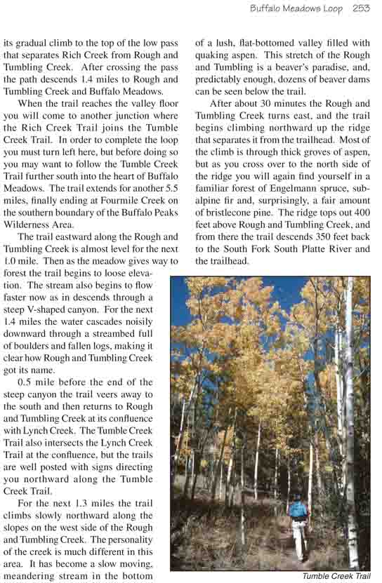
may want to follow the Tumble Creek Trail further south into the heart of
Buffalo Meadows. The trail extends for another 5.5 miles, finally ending at
Fourmile Creek on the southern boundary of the Buffalo Peaks Wilderness
Area.
The trail eastward along the Rough and Tumbling Creek is
almost level for the next 1.0 mile. Then as the meadow gives way to forest
the trail begins to loose elevation. The stream also begins to flow faster
now as in descends through a steep V-shaped canyon. For the next 1.4 miles
the water cascades noisily downward through a streambed full of boulders and
fallen logs, making it clear how Rough and Tumbling Creek got its name.
0.5 mile before the end of the steep canyon the trail
veers away to the south and then returns to Rough and Tumbling Creek at its
confluence with Lynch Creek. The Tumble Creek Trail also intersects the
Lynch Creek Trail at the confluence, but the trails are well posted with
signs directing you northward along the Tumble Creek Trail.
For the next 1.3 miles the trail climbs slowly northward
along the slopes on the west side of the Rough and Tumbling Creek. The
personality of the creek is much different in this area. It has become a
slow moving, meandering stream in the bottom of a lush, flat-bottomed valley
filled with quaking aspen. This stretch of the Rough and Tumbling is a
beaver’s paradise, and, predictably enough, dozens of beaver dams can be
seen below the trail.
After about 30 minutes the Rough and Tumbling Creek turns
east, and the trail begins climbing northward up the ridge that separates it
from the trailhead. Most of the climb is through thick groves of aspen, but
as you cross over to the north side of the ridge you will again find
yourself in a familiar forest of Engelmann spruce, subalpine fir and,
surprisingly, a fair amount of bristlecone pine. The ridge tops out 400 feet
above Rough and Tumbling Creek, and from there the trail descends 350 feet
back to the South Fork South Platte River and the trailhead.