Upheaval Dome Trail
excerpted from our book
Canyonlands National Park
Favorite Jeep Roads & Hiking Trails
pages 70-71
|
Buy book directly from the author!
Canyonlands National Park
Favorite Jeep Roads & Hiking Trails
- has access info for 75 trailheads
- 56 detailed trail maps
- 241 photographs
- loads of driving and hiking tips
|
regularly $14.95
now on sale for only
$11.95
click here
for book orders
|
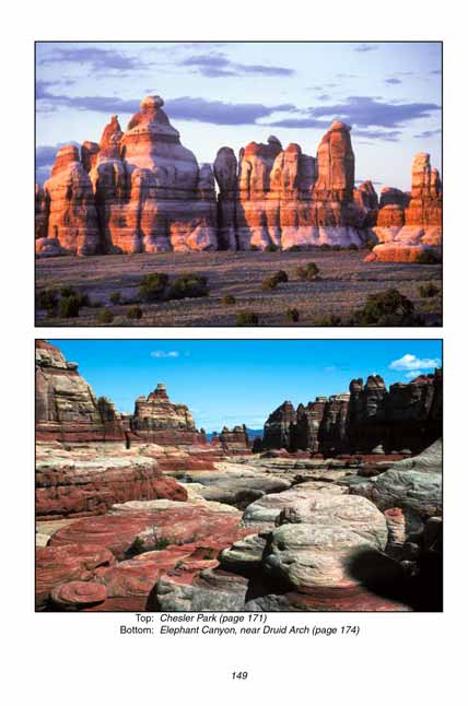
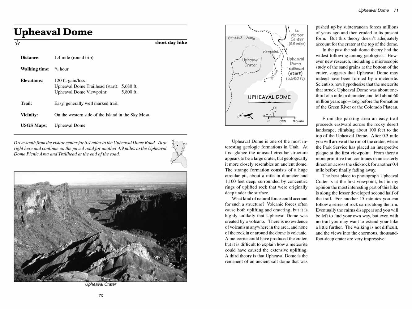 Upheaval Dome is one of the most interesting geologic formations in Utah. At first glance the unusual circular structure appears
to be a large crater, but geologically it more closely resembles an ancient dome. The strange formation consists of a huge circular pit, about a mile
in diameter and 1,100 feet deep, surrounded by concentric rings of uplifted rock that were originally deep under the surface.
Upheaval Dome is one of the most interesting geologic formations in Utah. At first glance the unusual circular structure appears
to be a large crater, but geologically it more closely resembles an ancient dome. The strange formation consists of a huge circular pit, about a mile
in diameter and 1,100 feet deep, surrounded by concentric rings of uplifted rock that were originally deep under the surface.
What kind of natural force could account for such a structure? Volcanic forces often cause both uplifting and cratering, but it is highly unlikely
that Upheaval Dome was created by a volcano. There is no evidence of volcanism anywhere in the area, and none of the rock in or around the
Upheaval Dome
is volcanic. A meteorite could have produced the crater, but it is difficult to explain how a meteorite could have caused the extensive uplifting.
A third theory is that Upheaval Dome is the remanent of an ancient salt dome that was pushed up by subterranean forces millions of years ago and
then eroded to its present form. But this theory doesn’t adequately account for the crater at the top of the dome.
In the past the salt dome theory had the widest following among geologists. However new research, including a microscopic study of the sand grains
at the bottom of the crater, suggests that Upheaval Dome may indeed have been formed by a meteorite. Scientists now hypothesize that the meteorite
that struck Upheaval Dome was about one-third of a mile in diameter, and fell about 60 million years ago-long before the formation of the Green River
or the Colorado Plateau.
From the parking area an easy trail proceeds eastward across the rocky desert landscape, climbing about 100 feet to the top of the Upheaval Dome.
After 0.3 mile you will arrive at the rim of the crater, where the Park Service has placed an interpretive plaque at the first viewpoint. From
there a more primitive trail continues in an easterly direction across the slickrock for another 0.4 mile before finally fading away.
The best place to photograph Upheaval Crater is at the first viewpoint, but in my opinion the most interesting part of this hike is along the
lesser developed second half of the trail. For another 15 minutes you can follow a series of rock cairns along the rim. Eventually the cairns
disappear and you will be left to find your own way, but even with no trail you may want to extend your hike a little further. The walking is
not difficult, and the views into the enormous, thousand-foot-deep crater are very impressive.
Note to web developers: You may copy this material onto your site, but in return please include a link to my home page
www.utahtrails.com. Thank you, David Day (utahdavidday at gmail.com)
Click here to see more trails in
Canyonlands National Park
© Rincon Publishing Company, all rights reserved
|