Slickrock Trail
excerpted from our book
Canyonlands National Park
Favorite Jeep Roads & Hiking Trails
pages 126-128
|
Buy book directly from the author!
Canyonlands National Park
Favorite Jeep Roads & Hiking Trails
- has access info for 75 trailheads
- 56 detailed trail maps
- 241 photographs
- loads of driving and hiking tips
|
regularly $14.95
now on sale for only
$11.95
click here
for book orders
|
 Slick rock is a Utah staple. The eternal wind whisks the dirt off whole hills and vales, leaving nothing but the framework, like a coyote with its hide peeled off.
David Lavender, 1943
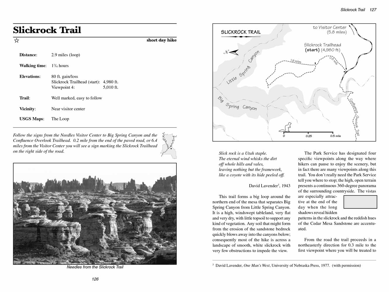
The Slickrock Trail forms a big loop around the northern end of the mesa that separates Big Spring Canyon from Little Spring Canyon.
It is a high, windswept tableland, very flat and very dry, with little topsoil to support any kind of vegetation.
Any soil that might form from the erosion of the sandstone bedrock quickly blows away into the canyons below;
consequently most of the hike is across a landscape of smooth, white slickrock with very few obstructions to impede the view.
The Park Service has designated four specific viewpoints along the
Slickrock Trail where hikers can pause to enjoy the scenery, but in fact there are many viewpoints along this trail.
You donĺt really need the Park Service tell you where to stop; the high, open terrain presents a continuous 360-degree panorama of the surrounding countryside.
The vistas are especially attractive at the end of the day when the long shadows reveal hidden patterns in the slickrock and the reddish hues of the Cedar Mesa Sandstone are accentuated.
 From the road the Slickrock Trail proceeds in a northeasterly direction for 0.3 mile to the first viewpoint where you will be treated to a gorgeous view of the La Sal Mountains.
The mountains are 40 miles away, but the air is usually so clear in this remote part of the United States that they look much closer.
After leaving the first viewpoint the Slickrock Trail turns north for another 0.2 miles, where you will see a primitive sign marking the beginning of the loop.
From the road the Slickrock Trail proceeds in a northeasterly direction for 0.3 mile to the first viewpoint where you will be treated to a gorgeous view of the La Sal Mountains.
The mountains are 40 miles away, but the air is usually so clear in this remote part of the United States that they look much closer.
After leaving the first viewpoint the Slickrock Trail turns north for another 0.2 miles, where you will see a primitive sign marking the beginning of the loop.
Bear right at the sign and soon you will see another sign directing you to the second viewpoint overlooking Little Spring Canyon.
The trail becomes somewhat rockier in this area as it climbs toward the northern end of the mesa. Again, the dominant view is of the La Sal Mountains.
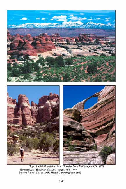
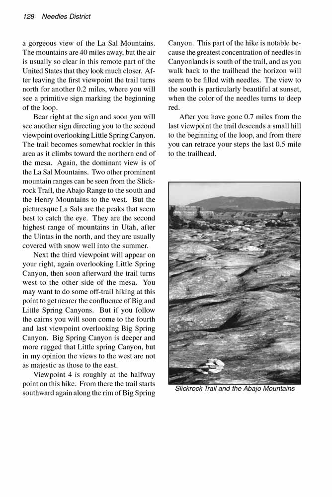
Two other prominent mountain ranges can be seen from the Slickrock Trail, the Abajo Range to the south and the Henry Mountains to the west.
But the picturesque La Sals are the peaks that seem best to catch the eye.
They are the second highest range of mountains in Utah, after the Uintas in the north, and they are usually covered with snow well into the summer.
Next the third viewpoint will appear on your right, again overlooking Little Spring Canyon, then soon afterward the trail turns west to the other side of the mesa.
You may want to do some off-trail hiking at this point to get nearer the confluence of Big and Little Spring Canyons.
But if you follow the cairns you will soon come to the fourth and last viewpoint overlooking Big Spring Canyon.
Big Spring Canyon is deeper and more rugged that Little spring Canyon, but in my opinion the views to the west are not as majestic as those to the east.
Viewpoint 4 is roughly at the halfway point on this hike. From there the Slickrock trail starts southward again along the rim of Big Spring Canyon.
This part of the hike is notable because the greatest concentration of needles in Canyonlands is south of the trail,
and as you walk back to the trailhead the horizon will seem to be filled with needles.
The view to the south is particularly beautiful at sunset, when the color of the needles turns to deep red.
After you have gone 0.7 miles from the last viewpoint the Slickrock trail descends a small hill to the beginning of the loop,
and from there you can retrace your steps the last 0.5 mile to the trailhead.
Note to web developers: You may copy this material onto your site, but in return please include a link to my home page
www.utahtrails.com. Thank you, David Day (utahdavidday at gmail.com)
Click here to see more trails in
Canyonlands National Park
ę Rincon Publishing Company, all rights reserved
|