Murphy Point Trail
excerpted from our book
Canyonlands National Park
Favorite Jeep Roads & Hiking Trails
pages 50-51
|
Buy book directly from the author!
Canyonlands National Park
Favorite Jeep Roads & Hiking Trails
- has access info for 75 trailheads
- 56 detailed trail maps
- 241 photographs
- loads of driving and hiking tips
|
regularly $14.95
now on sale for only
$11.95
click here
for book orders
|
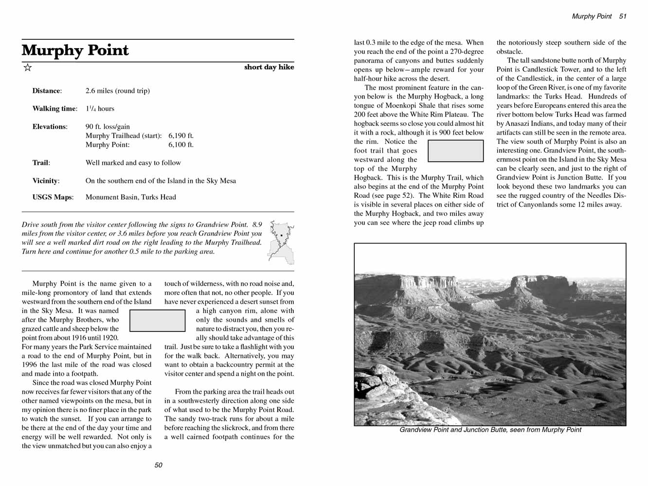 Murphy Point is the name given to a mile-long promontory of land that extends westward from the southern end of the Island in the
Sky Mesa. It was named after the Murphy Brothers, who grazed cattle and sheep below the point from about 1916 until 1920. For many years the Park
Service maintained a road to the end of Murphy Point, but in 1996 the last mile of the road was closed and made into a footpath.
Murphy Point is the name given to a mile-long promontory of land that extends westward from the southern end of the Island in the
Sky Mesa. It was named after the Murphy Brothers, who grazed cattle and sheep below the point from about 1916 until 1920. For many years the Park
Service maintained a road to the end of Murphy Point, but in 1996 the last mile of the road was closed and made into a footpath.
Since the road was closed Murphy Point now receives far fewer visitors that any of the other named viewpoints on the mesa, but in my opinion there is
no finer place in the park to watch the sunset. If you can arrange to be there at the end of the day your time and energy will be well rewarded. Not
only is the view unmatched but you can also enjoy a touch of wilderness, with no road noise and, more often that not, no other people. If you have
never experienced a desert sunset from a high canyon rim, alone with only the sounds and smells of nature to distract you, then you really should
take advantage of this trail. Just be sure to take a flashlight with you for the walk back. Alternatively, you may want to obtain a backcountry
permit at the visitor center and spend a night on the point.
From the parking area the trail heads out in a southwesterly direction along one side of what used to be the Murphy Point Road. The sandy two-track
runs for about a mile before reaching the slickrock, and from there a well cairned footpath continues for the last 0.3 mile to the edge of the mesa.
When you reach the end of the point a 270-degree panorama of canyons and buttes suddenly opens up below-ample reward for your half-hour hike across
the desert.
The most prominent feature in the canyon below is the Murphy Hogback, a long tongue of Moenkopi Shale that rises some 200 feet above the White Rim
Plateau. The hogback seems so close you could almost hit it with a rock, although it is 900 feet below the rim. Notice the foot trail that goes
westward along the top of the Murphy Hogback. This is the Murphy Trail, which also begins at the end of the Murphy Point Road (see page 52). The
White Rim Road is visible in several places on either side of the Murphy Hogback, and two miles away you can see where the jeep road climbs up the
notoriously steep southern side of the obstacle.
The tall sandstone butte north of Murphy Point is Candlestick Tower, and to the left of the Candlestick, in the center of a large loop of the Green
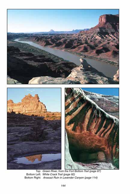
River, is one of my favorite landmarks: the Turks Head. Hundreds of years before Europeans entered this area the river bottom below Turks Head was
farmed by Anasazi Indians, and today many of their artifacts can still be seen in the remote area. The view south of Murphy Point is also an
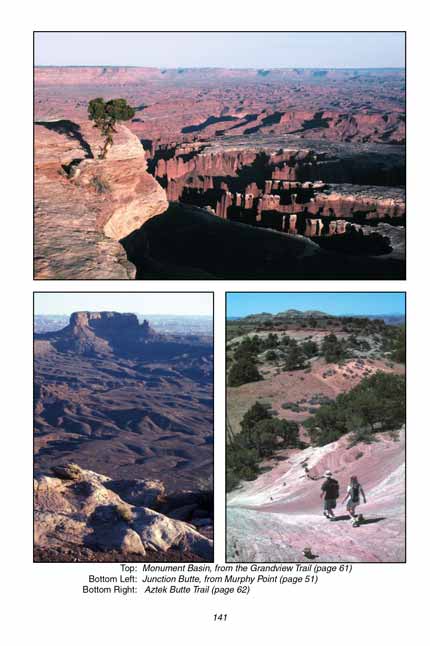
interesting one. Grandview Point, the southernmost point on the Island in the Sky Mesa can be clearly seen, and just to the right of Grandview
Point is Junction Butte. If you look beyond these two landmarks you can see the rugged country of the Needles District of Canyonlands some 12
miles away.
Note to web developers: You may copy this material onto your site, but in return please include a link to my home page
www.utahtrails.com. Thank you, David Day (utahdavidday at gmail.com)
Click here to see more trails in
Canyonlands National Park
© Rincon Publishing Company, all rights reserved
|