Lower Red Lake Canyon
excerpted from our book
Canyonlands National Park
Favorite Jeep Roads & Hiking Trails
pages 178-181
|
Buy book directly from the author!
Canyonlands National Park
Favorite Jeep Roads & Hiking Trails
- has access info for 75 trailheads
- 56 detailed trail maps
- 241 photographs
- loads of driving and hiking tips
|
regularly $14.95
now on sale for only
$11.95
click here
for book orders
|
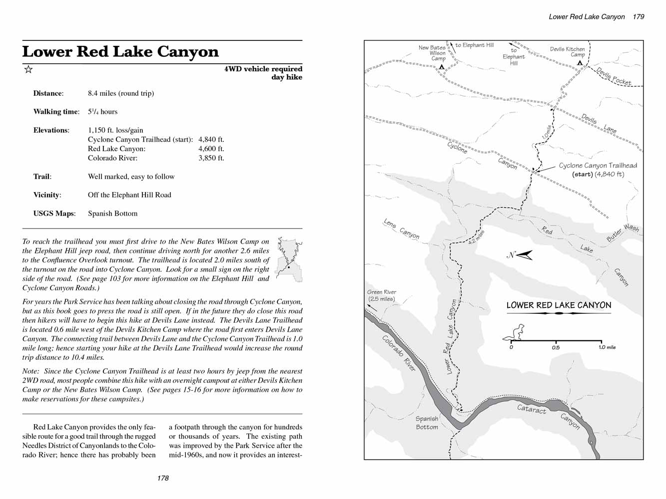 Red Lake Canyon provides the only feasible route for a good trail through the rugged Needles District of Canyonlands to the Colorado River;
hence there has probably been a footpath through the canyon for hundreds or thousands of years.
The existing path was improved by the Park Service after the mid-1960s, and now it provides an interesting way for hikers to see the Colorado River.
Red Lake Canyon provides the only feasible route for a good trail through the rugged Needles District of Canyonlands to the Colorado River;
hence there has probably been a footpath through the canyon for hundreds or thousands of years.
The existing path was improved by the Park Service after the mid-1960s, and now it provides an interesting way for hikers to see the Colorado River.
From the trailhead in Cyclone Canyon the trail immediately begins to descend westward through a small ravine that connects Cyclone Canyon to Red Lake Canyon.
After a distance of 0.7 miles and an elevation loss of 240 feet the trail reaches the sandy bottom of Red Lake Canyon, a huge, graben that seems to go on forever in both directions.
The trail then turns north and proceeds down the right side of the canyon for 0.3 mile before crossing to the opposite side and climbing out.
In spite of what the name suggests, there is no water in Red Lake Canyon. There are signs, however, that on rare occasions after a heavy rain there might be standing water in the depression for a brief time.
In some areas there is a great deal of dead juniper wood that appears to have been washed down from above.
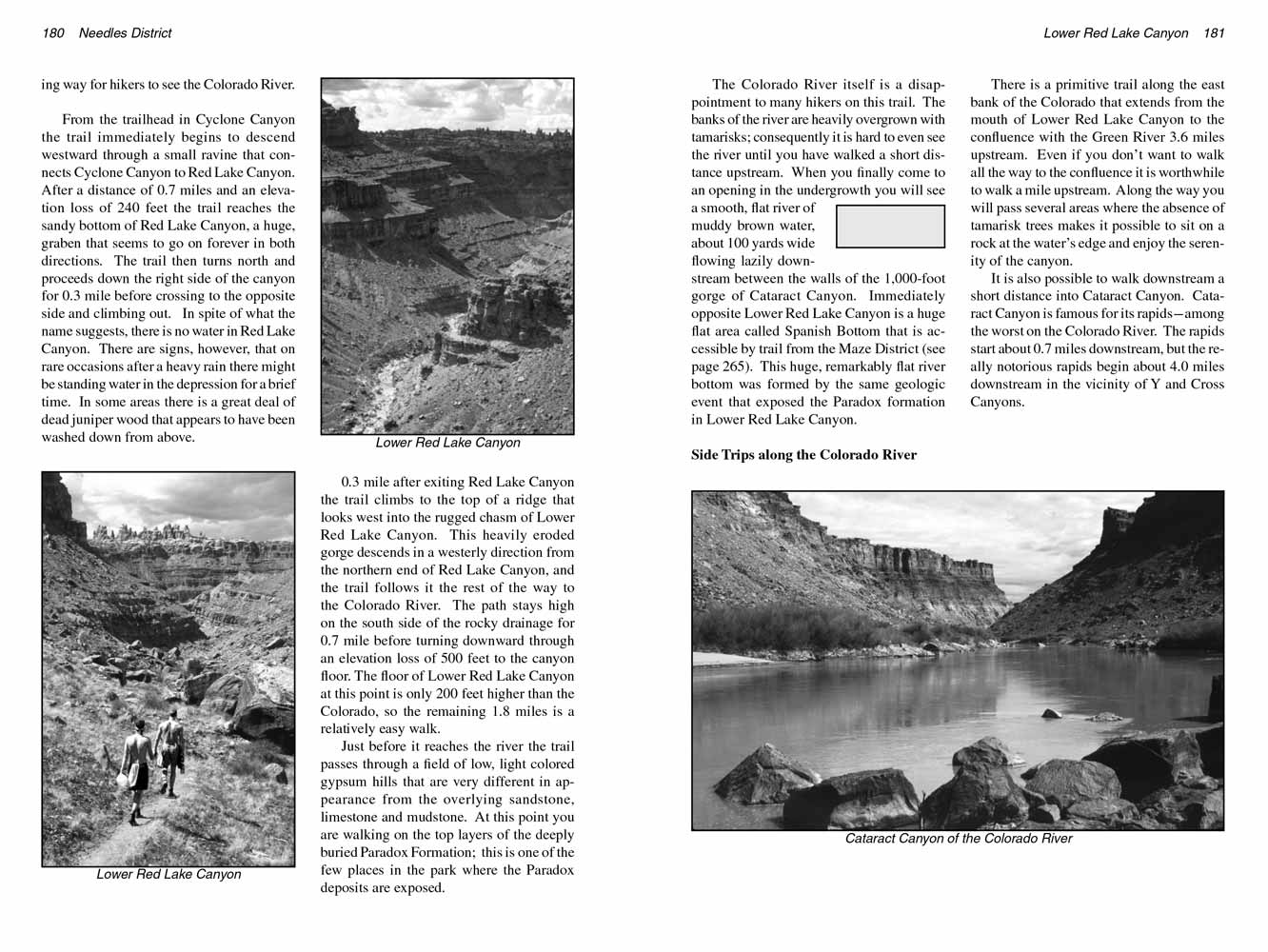
0.3 mile after exiting Red Lake Canyon the trail climbs to the top of a ridge that looks west into the rugged chasm of Lower Red Lake Canyon.
This heavily eroded gorge descends in a westerly direction from the northern end of Red Lake Canyon, and the trail follows it the rest of the way to the Colorado River.
The path stays high on the south side of the rocky drainage for 0.7 mile before turning downward through an elevation loss of 500 feet to the canyon floor.
The floor of Lower Red Lake Canyon at this point is only 200 feet higher than the Colorado, so the remaining 1.8 miles is a relatively easy walk.
 Just before it reaches the river the trail passes through a field of low, light colored gypsum hills that are very different in appearance from the overlying sandstone, limestone and mudstone.
At this point you are walking on the top layers of the deeply buried Paradox Formation; this is one of the few places in
Canyonlands National Park where the Paradox deposits are exposed.
Just before it reaches the river the trail passes through a field of low, light colored gypsum hills that are very different in appearance from the overlying sandstone, limestone and mudstone.
At this point you are walking on the top layers of the deeply buried Paradox Formation; this is one of the few places in
Canyonlands National Park where the Paradox deposits are exposed.
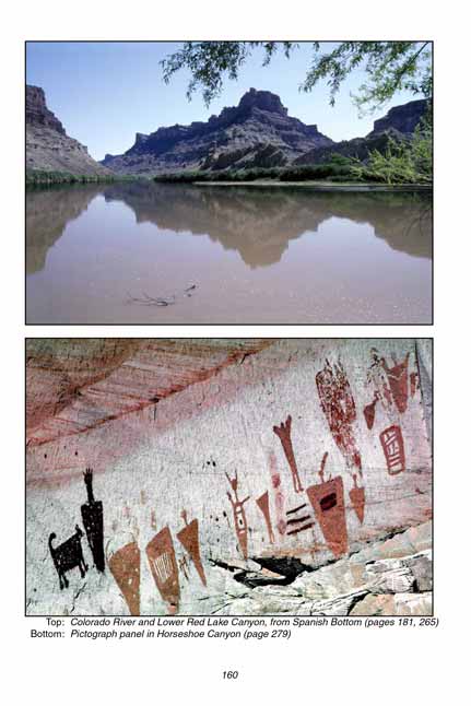
The Colorado River itself is a disappointment to many hikers on this trail.
The banks of the river are heavily overgrown with tamarisks; consequently it is hard to even see the river until you have walked a short distance upstream.
When you finally come to an opening in the undergrowth you will see a smooth, flat river of muddy brown water, about 100 yards wide flowing lazily downstream between the walls of the 1,000-foot gorge of Cataract Canyon.
Immediately opposite Lower Red Lake Canyon is a huge flat area called Spanish Bottom that is accessible by trail from the Maze District (see page 265).
This huge, remarkably flat river bottom was formed by the same geologic event that exposed the Paradox formation in Lower Red Lake Canyon.
Side Trips along the Colorado River
There is a primitive trail along the east bank of the Colorado that extends from the mouth of Lower Red Lake Canyon to the confluence with the Green River 3.6 miles upstream.
Even if you don’t want to walk all the way to the confluence it is worthwhile to walk a mile upstream.
Along the way you will pass several areas where the absence of tamarisk trees makes it possible to sit on a rock at the water’s edge and enjoy the serenity of the canyon.
It is also possible to walk downstream a short distance into Cataract Canyon. Cataract Canyon is famous for its rapids-among the worst on the Colorado River.
The rapids start about 0.7 miles downstream, but the really notorious rapids begin about 4.0 miles downstream in the vicinity of Y and Cross Canyons.
Note to web developers: You may copy this material onto your site, but in return please include a link to my home page
www.utahtrails.com. Thank you, David Day (utahdavidday at gmail.com)
Click here to see more trails in
Canyonlands National Park
© Rincon Publishing Company, all rights reserved
|