Gooseneck Trail
excerpted from our book
Canyonlands National Park
Favorite Jeep Roads & Hiking Trails
pages 89-91
|
Buy book directly from the author!
Canyonlands National Park
Favorite Jeep Roads & Hiking Trails
- has access info for 75 trailheads
- 56 detailed trail maps
- 241 photographs
- loads of driving and hiking tips
|
regularly $14.95
now on sale for only
$11.95
click here
for book orders
|
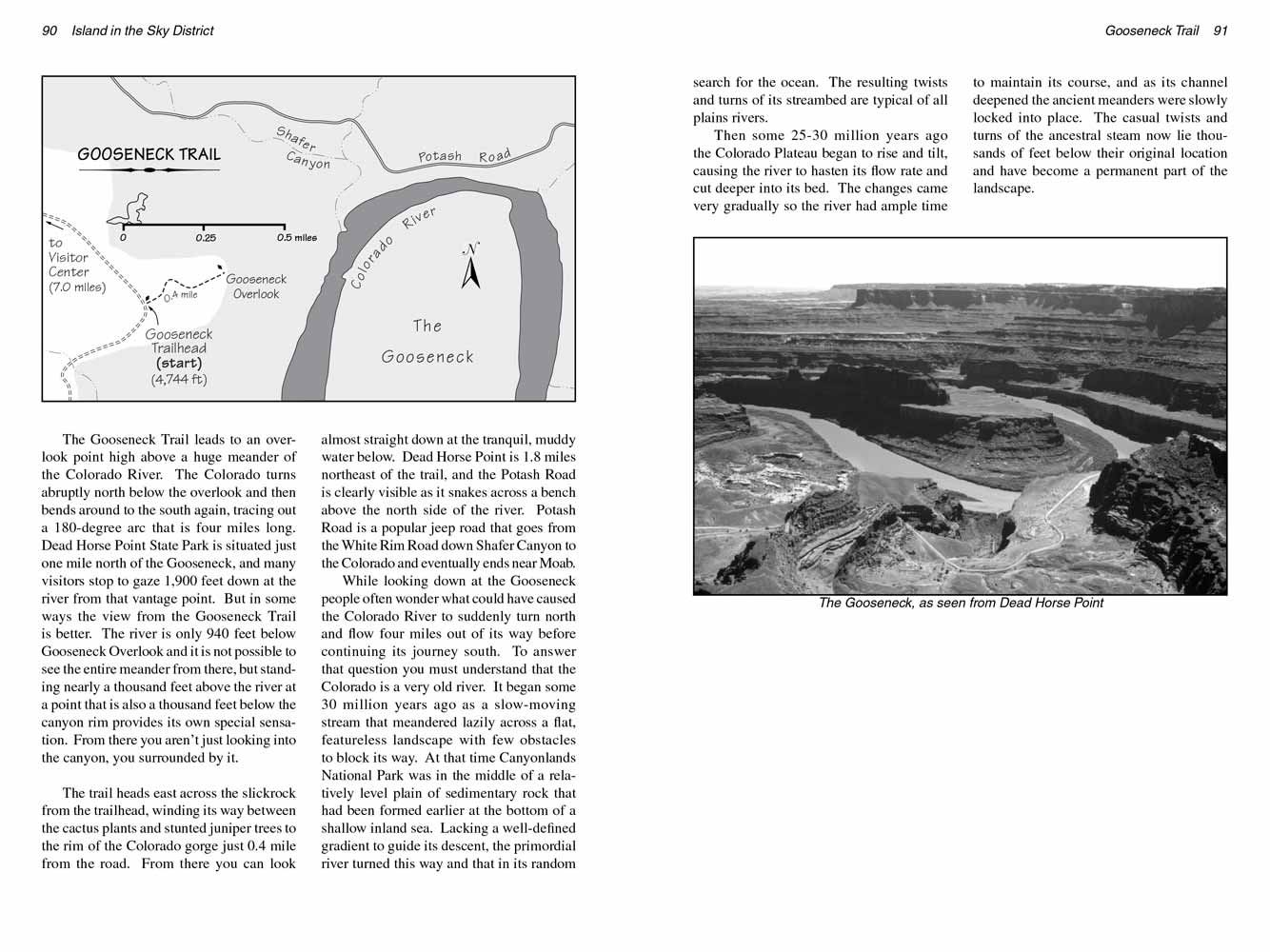
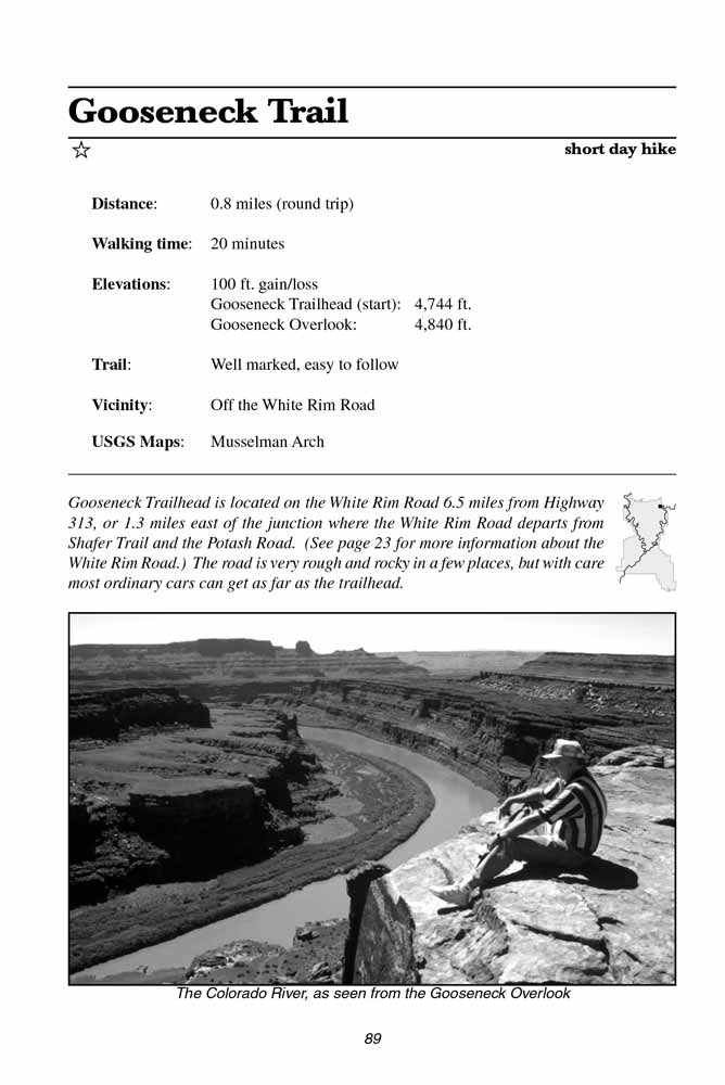 The Gooseneck Trail leads to an overlook point high above a huge meander of the Colorado River. The Colorado turns abruptly
north below the overlook and then bends around to the south again, tracing out a 180-degree arc that is four miles long. Dead Horse Point State Park
is situated just one mile north of the Gooseneck, and many visitors stop to gaze 1,900 feet down at the river from that vantage point. But in some
ways the view from the Gooseneck Trail is better. The river is only 940 feet below Gooseneck Overlook and it is not possible to see the entire meander
from there, but standing nearly a thousand feet above the river at a point that is also a thousand feet below the canyon rim provides its own special
sensation. From there you aren’t just looking into the canyon, you surrounded by it.
The Gooseneck Trail leads to an overlook point high above a huge meander of the Colorado River. The Colorado turns abruptly
north below the overlook and then bends around to the south again, tracing out a 180-degree arc that is four miles long. Dead Horse Point State Park
is situated just one mile north of the Gooseneck, and many visitors stop to gaze 1,900 feet down at the river from that vantage point. But in some
ways the view from the Gooseneck Trail is better. The river is only 940 feet below Gooseneck Overlook and it is not possible to see the entire meander
from there, but standing nearly a thousand feet above the river at a point that is also a thousand feet below the canyon rim provides its own special
sensation. From there you aren’t just looking into the canyon, you surrounded by it.
Gooseneck Trail heads east across the slickrock from the trailhead, winding its way between the cactus plants and stunted juniper trees to the rim of the
Colorado gorge just 0.4 mile from the road. From there you can look almost straight down at the tranquil, muddy water below. Dead Horse Point is
1.8 miles northeast of the trail, and the Potash Road is clearly visible as it snakes across a bench above the north side of the river. Potash Road
is a popular jeep road that goes from the White Rim Road down Shafer Canyon to the Colorado and eventually ends near Moab.
 While looking down at the Gooseneck people often wonder what could have caused the Colorado River to suddenly turn north and flow
four miles out of its way before continuing its journey south. To answer that question you must understand that the Colorado is a very old river.
It began some 30 million years ago as a slow-moving stream that meandered lazily across a flat, featureless landscape with few obstacles to block
its way. At that time Canyonlands National Park was in the middle of a relatively level plain of sedimentary rock that had been formed earlier at
the bottom of a shallow inland sea. Lacking a well-defined gradient to guide its descent, the primordial river turned this way and that in its
random search for the ocean. The resulting twists and turns of its streambed
below Gooseneck Trail are typical of all plains rivers.
While looking down at the Gooseneck people often wonder what could have caused the Colorado River to suddenly turn north and flow
four miles out of its way before continuing its journey south. To answer that question you must understand that the Colorado is a very old river.
It began some 30 million years ago as a slow-moving stream that meandered lazily across a flat, featureless landscape with few obstacles to block
its way. At that time Canyonlands National Park was in the middle of a relatively level plain of sedimentary rock that had been formed earlier at
the bottom of a shallow inland sea. Lacking a well-defined gradient to guide its descent, the primordial river turned this way and that in its
random search for the ocean. The resulting twists and turns of its streambed
below Gooseneck Trail are typical of all plains rivers.
Some 25-30 million years ago the Colorado Plateau began to rise and tilt, causing the river to hasten its flow rate and cut deeper into its bed.
The changes came very gradually so the river had ample time to maintain its course, and as its channel deepened the ancient meanders were slowly locked
into place. The casual twists and turns of the ancestral steam now lie thousands of feet below their original location and have become a permanent
part of the landscape.
Note to web developers: You may copy this material onto your site, but in return please include a link to my home page
www.utahtrails.com. Thank you, David Day (utahdavidday at gmail.com)
Click here to see more trails in
Canyonlands National Park
© Rincon Publishing Company, all rights reserved
|