|
Links to other sites:
Ordering books & Maps
Comments about this site or our book:

|
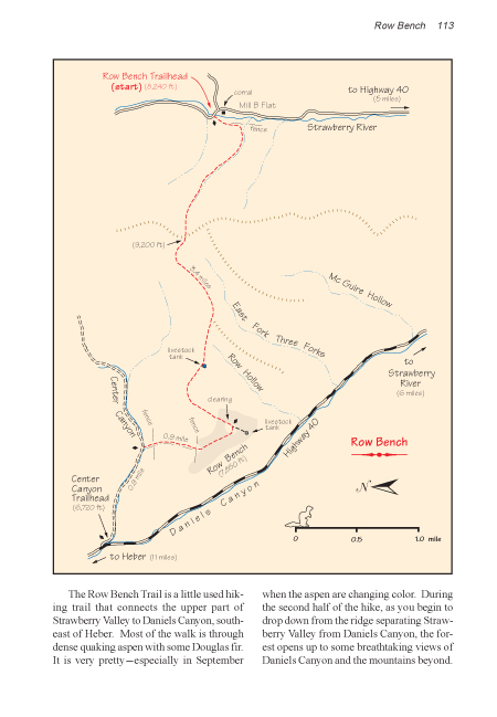
The Row Bench Trail is a little
used hiking trail that connects the upper part of Strawberry
Valley to Daniels Canyon, southeast of Heber. Most of the walk
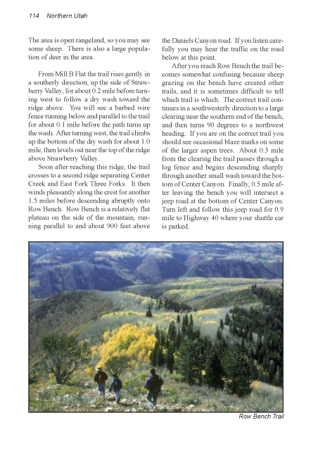
is through dense quaking aspen with some Douglas fir. It is very
pretty-especially in September when the aspen are changing color.
During the second half of the hike, as you begin to drop down
from the ridge separating Strawberry Valley from Daniels Canyon,
the forest opens up to some breathtaking views of Daniels Canyon
and the mountains beyond. The area is open rangeland, so you
may see some sheep. There is also a large population of deer
in the area.
From Mill B Flat the trail rises
gently in a southerly direction, up the side of Strawberry Valley,
for about 0.2 mile before turning west to follow a dry wash towards
the ridge above. You will see a barbed wire fence running below
and parallel to the trail for about 0.1 mile before the path
turns up the wash. After turning west, the trail climbs up the
bottom of the dry wash for about 1.0 mile, then levels out near
the top of the ridge above Strawberry Valley.
Soon after reaching this ridge,
the trail crosses to a second ridge separating Center Creek and
East Fork Three Forks. It then winds pleasantly along the crest
for another 1.5 miles before descending abruptly onto Row Bench.
Row Bench is a relatively flat plateau on the side of the mountain,
running parallel to and about 900 feet above the Daniels Canyon
road. If you listen carefully you may hear the traffic on the
road below at this point.
After you reach Row Bench the trail
becomes somewhat confusing because sheep grazing on the bench
have created other trails, and it is sometimes difficult to tell
which trail is which. The correct trail continues in a southwesterly
direction to a large clearing near the southern end of the bench,
and then turns 90 degrees to a northwest heading. If you are
on the correct trail you should see occasional blaze marks on
some of the larger aspen trees. About 0.3 mile from the clearing
the trail passes through a log fence and begins descending sharply
through another small wash towards the bottom of Center Canyon.
Finally, 0.5 mile after leaving the bench you will intersect
a jeep road at the bottom of Center Canyon. Turn left and follow
this jeep road for 0.9 mile, to Highway 40, where your shuttle
car is parked. |